
Time-series remote sensing with high-resolution imagery has allowed many industries and users the ability to detect changes in land use and land cover over time. Office of Surface Mining Reclamation and Enforcement (OSMRE) has contracted with Planet Labs for access to their catalog of PlanetScope SuperDove cubesat imagery. Cubesats, which are small, inexpensive imaging satellites about the size of a shoebox, are launched on a regular basis. The constellation of satellites operated by Planet means they can provide multispectral imagery of the entire Earth every day at a high (3- to 5-meter) spatial resolution. Access to Planet’s image catalog enhances OSMRE’s ability to observe mining and reclamation activities at sites that are remote and difficult to access. Daily or sub-daily imagery makes it easier for OSMRE to evaluate mining production activity and measure the performance of reclamation processes over time.
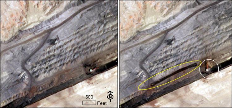
Images of a coal mine acquired 35 minutes apart by SuperDove cubesat satellites. The image on the left was taken on June 21, 2022, at 11:02 AM local time, and the image on the right was taken at 11:37 AM local time. Active mining is observed from position changes of the dragline (within the white circle) and other mining equipment within the elapsed time. The dragline boom orientation changes from 2 o’clock in the earlier image to 12 o’clock in the later one. New surface wetting and hauling activity can be seen within the yellow oval area on the right.
Disclaimer: Any use of trade, firm, or product names is for descriptive purposes only and does not imply endorsement by the U.S. Government.