
Commercial high-resolution multispectral imagery is available in resolutions down to 25 centimeters but can be obscured by clouds. Office of Surface Mining Reclamation and Enforcement (OSMRE) observes two mine sites in the State of Washington where it is difficult to obtain cloud-free imagery. OSMRE worked with the Civil Applications Committee (CAC), an inter-agency committee that coordinates and oversees the Federal civil use of classified collections, to evaluate a possible solution: high-resolution synthetic aperture radar (SAR), which is an active remote sensing system that penetrates cloud cover. SAR can also aid in highlighting features that can be difficult to see in multispectral imagery. OSMRE is working to incorporate more SAR products into the virtual inspection workflow, particularly for critical infrastructure and emergency situations. Access to both SAR and multispectral imagery helps OSMRE meet its mission requirements under the Surface Mining Control and Reclamation Act of 1977 and better prepare for climatic impacts on active, inactive, and abandoned coal mines in the United States.
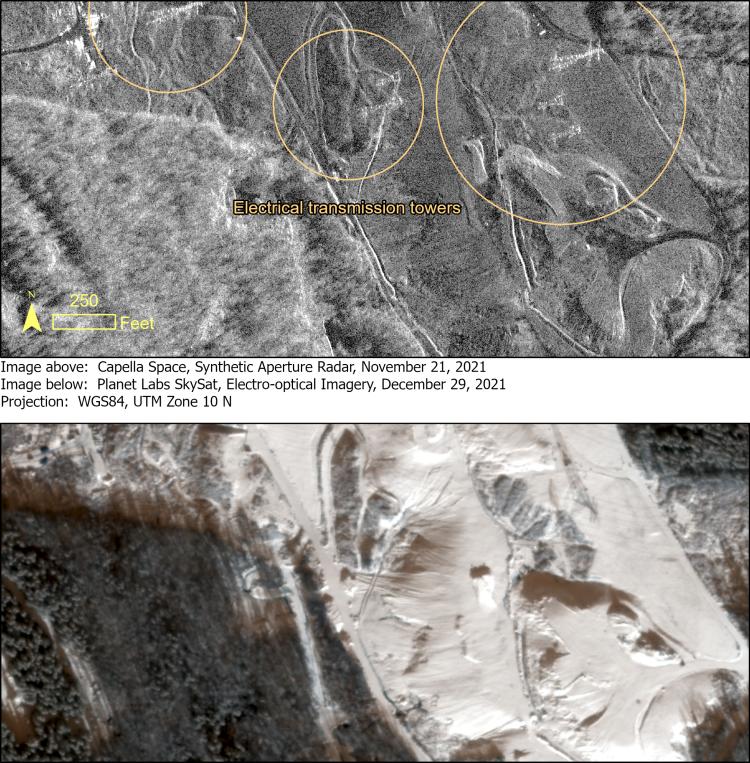
Comparison of SAR and multispectral imagery of a former coal mine showcases the relative advantages of each imaging method. Electrical transmission lines in the SAR image (top) are easier to observe than in the multispectral image (bottom). The multispectral image is useful for providing context to the SAR image; features such as the material piles, pits, forested areas, and haul roads are typically more easily recognizable in natural color.
Disclaimer: Any use of trade, firm, or product names is for descriptive purposes only and does not imply endorsement by the U.S. Government.