
The potential implications of climate change on Pacific salmon are a concern to resource managers in Alaska as warming trends continue in high-latitude streams. Temperature monitoring is needed to assess the potential ecological changes to salmon spawning habitat in coldwater refugia streams. The Funny River and Moose River are two coldwater streams on the Kenai National Wildlife Refuge that support a variety of salmon species. Salmon were tagged with radio transmitters equipped with thermochrons to track fish movement relative to water temperature. Temperature data are also being collected repeatedly from these streams using thermal infrared imagery and temperature data loggers placed at several locations along the streams. The high-resolution thermal maps provide continuous temperature data across the entire stream surface instead of single point data from the loggers.
Thermal infrared and color (red/green/blue [RGB]) images were acquired using two cameras mounted externally to a fixed-wing aircraft. A FLIR SC8340 MWIR (Medium Wave Infrared) camera with a 25-millimeter lens acquired radiometric images at 1-second intervals, while a PhaseOne iXM 100 Mb camera with a 35-millimeter lens acquired RGB photos at 4-second intervals. A Trimble R7 GNSS receiver was used to record camera positions. The aircraft flew at an average speed of about 80 knots and 3,000 feet above the ground. Transects were flown about 1,200 feet apart to provide the image overlap necessary to mosaic the images. Approximately 100 kilometers of stream were imaged in about 3 hours. Weekly flights were scheduled from mid-June with plans to collect through the open water season in mid-October 2022.
The FLIR images were processed to calibrate the temperature data using atmospheric conditions such as humidity and temperature and exported as radiometric tiffs. Structure from Motion (SfM) software was used to create orthomosaics from the thermal and RGB images, with final spatial resolutions of 50 centimeters (thermal) and 10 centimeters (RBG). The thermal orthomosaics will be compared with in-stream temperature data loggers to determine if thermal imaging flights are an accurate and economical way to monitor stream temperature.
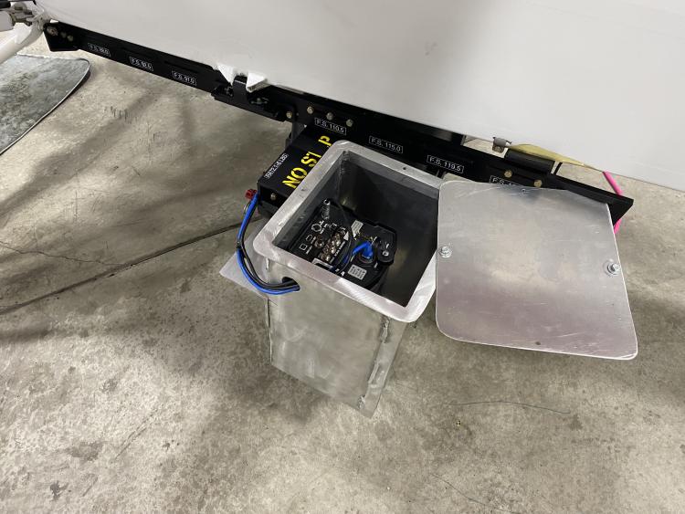
FLIR thermal camera mounted under fixed-wing aircraft.
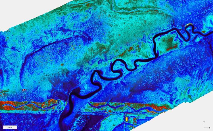
A section of the Moose River thermal mosaic.
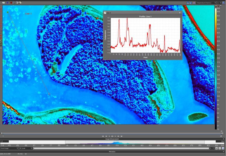
Thermal profile of radiometric image.
Disclaimer: Any use of trade, firm, or product names is for descriptive purposes only and does not imply endorsement by the U.S. Government.