The State of New Mexico Abandoned Mine Land Program is exploring remote sensing techniques to monitor land cover change over time. High-resolution satellite images and aerial photography in conjunction with ground surveys were used to measure reclamation success for the Swastika Mine and the Dutchman Canyon project in northern New Mexico. The objectives of using remotely sensed data in this project were to: 1) develop a baseline dataset to support multi-year change detection analysis of revegetation and stream channel form over a large area, and 2) develop the methodology to apply to other potential reclamation projects.
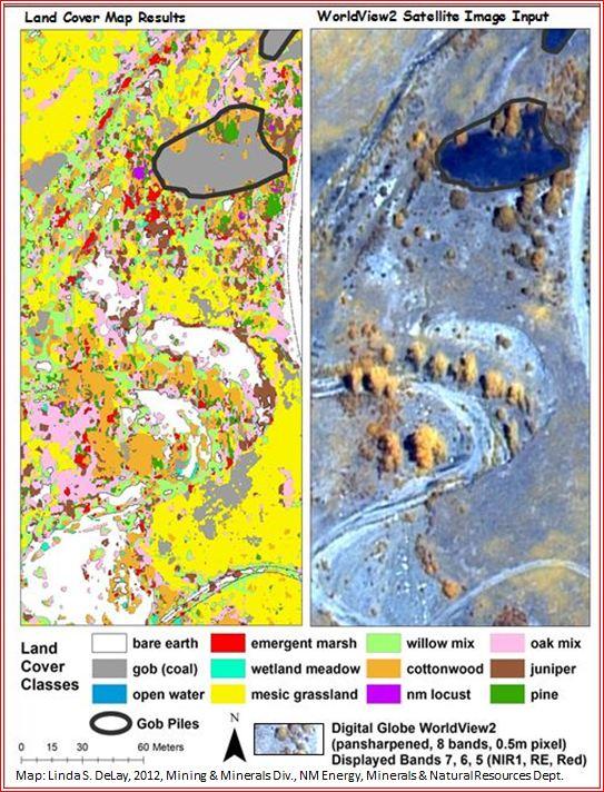
A pre-geomorphic construction land cover map was created using a pansharpened WorldView-2 satellite image processed from a pair of stereo images. The stereo images allow for creation of a digital terrain model. Twelve cover classes were mapped based on a supervised classification using ERDAS IMAGINE® 2011 software (figure below).
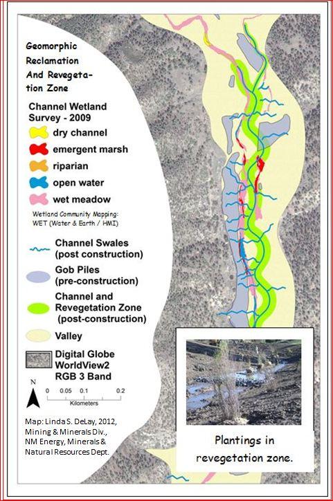
The geomorphic reclamation plan called for the coal spoils to be redistributed and buried beneath a reformed valley. The reclamation also reformed the drainages to a more natural landform.
After the geomorphic reclamation construction process, wetland vegetation was planted in and along the channel. Final plantings of willow and cottonwood poles, native shrubs, and seeds of grass / forb mixes will be completed before summer 2013 (figure below). Plans are to analyze imagery in 1- to 2-year intervals and pair the imagery with ground monitoring surveys to monitor vegetation and channel changes. Reclamation for the mines was completed in summer 2012. Additional ground verification and re-classification is in process.
Land cover classes developed from a supervised classification in ERDAS IMAGINE 2011 using WorldView-2 satellite imagery along a section of stream channel.
Area of geomorphic reclamation and the proposed revegetation zone during a 2012 design.


