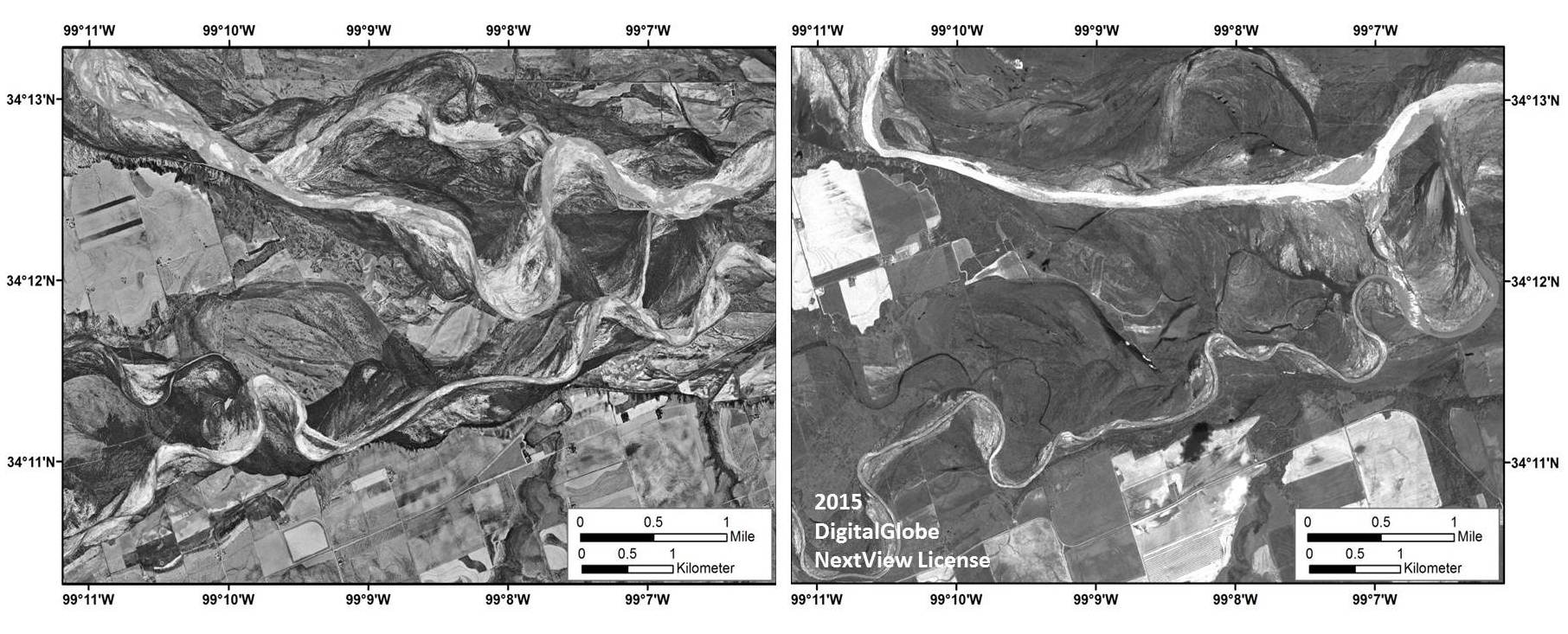
The BLM National Operations Center (NOC) is using multi-date aerial photography and remotely sensed imagery to delineate recent and historical water cover extents and gradients of the Red River (Texas/Oklahoma) in support of the BLM New Mexico State Office (NMSO).
Digital products identifying Red River surface water cover were derived using Sentinel-1A Polarimetric Synthetic Aperture Radar (PolSAR) collected in late May 2015. These products provided BLM officials with a “snapshot” of the Red River following widespread flooding in Texas in late spring 2015. SAR provided the only broad-coverage, moderate-resolution, cloud-free remotely sensed data available during this period, due to its ability to collect Earth observation information during inclement weather.
Large-scale historical aerial photography from 1953 was used to derive orthophoto mosaics and elevation models to serve as a baseline to identify course changes in the river through time. Other products from this effort include orthocorrected, pan-sharpened image mosaics derived from WorldView-2 satellite imagery collected on May 31, 2015, that captured the Red River’s peak water flow conditions, as well as multi-date, aircraft-acquired, high-resolution multispectral imagery. Analysis of these multi-temporal datasets underscores the highly dynamic nature of the Red River.

Aerial photography collected in 1953 (left) and WorldView-2 high-resolution panchromatic imagery acquired May 31, 2015, following flooding in Texas (right). These images are being used to identify and characterize temporal water cover trends along the Red River. North is oriented toward the top of the image.

