
Wetlands make up less than 1% of West Virginia’s land surface but are critical habitat for nearly one-fourth of its species, including 44% of its rare plant species. They also provide other benefits, including improved water quality as well as flood and erosion control.
The FWS National Wetlands Inventory (NWI) Program is the Federal repository of wetlands data and is used by government agencies, industry, non-profits, and individuals to promote the conservation and restoration of wetlands, and inform wetland science, policy, and best management practices. The State of West Virginia uses NWI data as the primary data input to a GIS-based tool developed to assess wetland functions such as water storage and habitat. Once the function(s) is determined, each wetland is given a score to qualify its value within the ecosystem. The State shares these GIS-based wetland function scores with the public and uses them for regulatory assessments.
In 2019, NWI collaborated with the West Virginia Department of Environmental Protection (DEP) to fund wetland mapping updates for over 2.8 million acres in eight counties. Areas chosen for mapping contain critical wetland habitats facing pressure from development and pollution. Wetland identification and classification were completed using Environmental Systems Research Institute, Inc. (ESRI) ArcMap software and National Agriculture Imagery Program 2019 digital orthomosaic imagery. Ancillary data sources were also used, including USGS National Elevation Dataset at 3- and 10-meter resolution, soil survey maps from the United States Department of Agriculture (USDA) Soil Survey Geographic Database (SSURGO) and State Soil Geographic Database (STATSGO) as well as imagery, elevation and lidar data from the West Virginia Department of Environmental Protection (WVDEP). Wetlands were classified in accordance with the Classification of Wetlands and Deepwater Habitats of the United States (Federal Geographic Data Committee 2013) and Data Collection Requirements and Procedures for Mapping Wetland, Deepwater, and Related Habitats of the United States (Dahl et al. 2020). More than 34,000 wetland features were mapped within the project area. These updated features were used by the State to re-evaluate the wetlands within this area, providing the most accurate functional assessment for these vital habitats.
In 2021, these updated data were incorporated into the NWI national geospatial dataset and served online to the public via the Wetlands Mapper. Additionally, West Virginia is working with the U.S. Army Corps of Engineers to adopt its NWI-based wetland function scores with rapid field assessment as the basis for regulatory assessment. This will allow the State to contribute science-based data to wetland protection and mitigation under the Clean Water Act. Improved and updated NWI mapping translates directly to better estimation of wetland functions statewide, and supports protection of these valuable resources.
https://www.fws.gov/wetlands/index.html
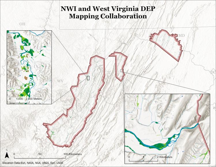
Locations of new wetland mapping, covering eight counties and over 2.8 million acres in West Virginia.