
Using close-range photography to create finely detailed 3D models of culturally significant archeological sites facilitates both documentation and research. The Bureau of Land Management (BLM) Buffalo Field Office hosted its 14th Volunteer Archeology Project the week of June 26, 2022, utilizing the Passport in Time (PIT) program. The 2022 project area in northern Wyoming was chosen due to the presence of two unique rock art sites, one prehistoric (pre-European settlement) and one historic (post-European settlement).
The prehistoric site consists of an anthropomorphic figure first documented in 1978 during an archeological survey for a conventional oil well location. During a site revisit in 2009, BLM archeologists recorded substantial damage to the figure due to centuries of natural weathering of the relatively soft sandstone face. The prehistoric anthropomorph is stylistically similar to figures recorded at other sites in northern Wyoming.
In 2013, BLM archeologists discovered a nearby historic inscription site. This unique site features nearly life-sized anthropomorphs that depict two people, one in a bowler hat and one in a military uniform; a star; and an inscription. The soldier appears to wear a European World War I uniform, so the figures are estimated to have been produced between 1912 and 1930. Research to translate the inscription and attribute the source and meaning of the rock art is ongoing.
In 2022, a volunteer crew helped document both archeological sites using a handheld digital camera and photogrammetry techniques. Surface models and sub-millimeter image orthomosaics were created from stereo images collected at each site. The use of photogrammetry at the prehistoric and historic rock art sites provides a detailed recording of site conditions and elements that researchers can use to monitor weathering and erosion. The two sites, physically close together, represent centuries of human use of the landscape.
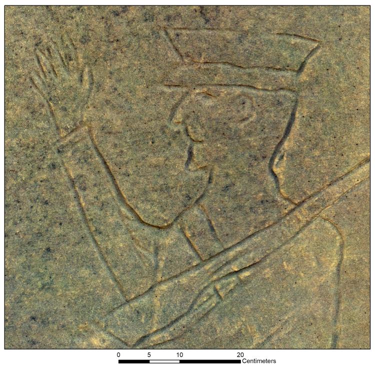
Portion of vertical rock face in which a nearly life-sized figure in a military-style uniform is carved. The entire rock face was modelled with multi-view stereo photogrammetry to create 3D models, detailed surface models, and a scaled orthomosaic. Photo credit: Ardy Hahn (Bureau of Land Management).
Disclaimer: Any use of trade, firm, or product names is for descriptive purposes only and does not imply endorsement by the U.S. Government.