
The Beaver Creek Petroglyph Site (48BH4293) is an undocumented rock art site containing some 26 panels of pictographs and petroglyphs that span from Early Hunting to En-Toto Pecked to Mountain Foothill Traditions.
In roughly 40 labor-hours, two field personnel acquired over 14,000 high-resolution close-range photogrammetric images (full stereo coverage) along a 225-foot vertical cliff face. Images were acquired using a handheld or pole-mounted digital single lens reflex camera positioned 10 feet from the cliff face, both with and without calibrated scale bars placed on the rock face. This process allows the creation of a scaled model without visible scale bars in the final product. Images were also acquired at small scale from the opposing cliffs ~660 feet away. Finally, images were acquired of a Paleoindian-aged panel at very close range (~1 foot), which enhances the model’s accuracy in this area.
All images were processed in a single block to create a 3D model from which scaled GIS products were produced, including multi-scale orthomosaics, surface models, 3D models, and point clouds. Achieving a similar level of documentation detail with traditional site surveys would have taken approximately 240 labor-hours. These products will greatly expedite the completion of Wyoming Cultural Property Forms, including panel forms, line drawings, and tracings.
This resource is potentially eligible under the National Register of Historic Places, Criteria A (“Event”, the site contributes to the broad pattern of American history) & D (“Information potential”, the site yields information important to prehistory or history). Use of the 3D model will facilitate virtual coordination with Tribal partners to elicit their perspectives on traditional religious / cultural significance, therefore informing potential management considerations. Additionally, the site has been subject to vandalism, so establishing baseline data will enable detection of any future change of condition. The site is an ideal candidate for the Wyoming Site Stewardship Program.
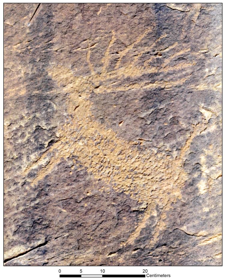
Early Hunting Tradition image from the Beaver Creek petroglyph panel. The image is a portion of the mosaic generated using the described processing methods.
Disclaimer: Any use of trade, firm, or product names is for descriptive purposes only and does not imply endorsement by the U.S. Government.