
Coastal erosion, exacerbated by sea-level rise, threatens natural, cultural, and recreation resources in the King Range National Conservation Area (NCA) on the northern California coast. Within this otherwise steep landscape, the flat coastal terrace provides a suitable location for recreation infrastructure, including two historic lighthouses and the popular Lost Coast Trail. Over the course of a week in July 2022, Bureau of Land Management (BLM) National Operations Center (NOC) staff collected high-resolution 3D data using a handheld laser scanner to document coastal erosion. Lidar scans were collected at four priority monitoring zones identified by the Arcata Field Office (AFO). Coverage of all four sites required 22 separate scans and resulted in average ground point densities of ~600 points/square meter. Control points were surveyed using a global navigation satellite system (GNSS) receiver at each zone to adjust each lidar scan to a coordinate reference system. The georeferencing root mean square errors for all scans were within 0.09 meters. NOC staff plan to include this new dataset in ongoing change detection analyses using existing aerial lidar and photogrammetric datasets to identify hotspots of erosion and quantify the rate of retreat of the coastal terrace. This analysis will help the AFO prioritize where to focus mitigation and response efforts and constrain a timeline for the protection and management of resources along the King Range NCA coastline.
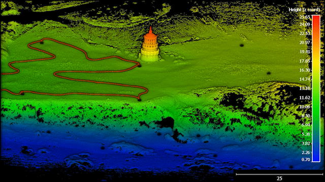
A 3D point cloud, colored by elevation values, of Mal Coombs Park and the relocated Cape Mendocino Lighthouse in Shelter Cove, California. The scale bar (bottom right) and the point color scale are in meters. The lower beach (blue points) and coastal terrace (green points) are separated by a ~15-meter cliff that is rapidly eroding. An example of the trajectory taken by the 3D laser scanner is shown on the upper area near the lighthouse. The control points used to georeference the point cloud are also shown.
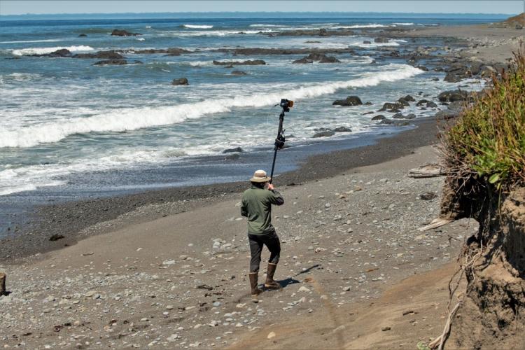
Bureau of Land Management National Operations Center (BLM NOC) staff member Julian Cross operating the 3D laser scanner (mounted on a monopod) at the Punta Gorda monitoring site; the coastal cliff is visible in the lower right. Photo credit: Mark Gapinski (BLM NOC).
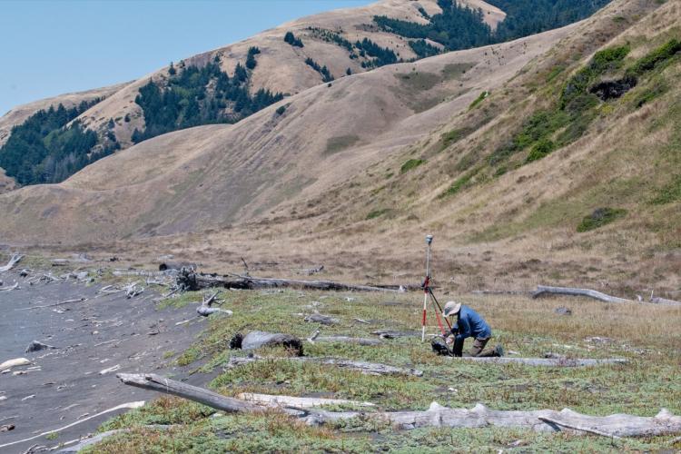
Bureau of Land Management National Operations Center (BLM NOC) staff member Jake Slyder surveying a ground control point on the coastal terrace at the Spanish Flat site. Photo credit: Mark Gapinski (BLM NOC).
Disclaimer: Any use of trade, firm, or product names is for descriptive purposes only and does not imply endorsement by the U.S. Government.