
The Northeast Archeological Resources Program (NARP) supports archeological resource planning, research, and baseline inventory and evaluation of archeological resources in the Interior Region 1 North Atlantic-Appalachian (formerly Northeast Region). NARP uses a suite of tools in their work with archeological resources including Geographic Information Systems (GIS) and Global Positioning Systems (GPS), with an integrated program of remote sensing to contribute to the enhancement of archeological resource management.
In 2022 NARP is transitioning to Real Time Kinematic (RTK) Global Navigation Satellite Systems (GNSS) for field data capture for survey grid positioning, topographic mapping, and metallic survey (archeological metal detection) artifact mapping.
Archeological resources are sensitive data with restricted access. NARP works exclusively in GIS and the NPS firewall-secured geospatial online service (Portal) with preparation, syncing, and integration of data for ease of data review and editing, collaboration, and to support initiatives such as the Volunteer Archeology Monitoring Program (VAMP). This program engages volunteer and partner participation in stewardship of archeological resources, providing “eyes on the ground” capacity using the VAMP monitoring field application to support parks in monitoring site condition and identifying threats and damage to archeological resources.
NARP applies an integrated approach to Section 106 archeological compliance and Section 110 baseline inventory and evaluation, combining remote sensing techniques with traditional archeological methods. Contracted Section 106 archeological compliance, including to support Great American Outdoors Act (GAOA - New River Gorge National Park and Preserve, Minute Man National Historical Park, and Boston National Historical Park ), and Section 110 inventory and evaluation projects can include a combination of available airborne lidar data, historic and current aerial photos, and multiple geophysical survey methods that can include ground penetrating radar (GPR), magnetic gradient, electrical resistivity, conductivity, magnetic susceptibility, and archeological metal detection.
Examples of NARP integration of remote sensing in 2022 compliance and baseline inventory projects:
- Longfellow House – George Washington’s Headquarters – Integration of aboveground terrestrial laser scanning, scanned excavation units, and belowground GPR data. This research seeks to provide a new opportunity for visualizing the park and its archeological resources while making the resulting archeological data and interpretations more accessible to the public.
- Werowocomoco – Captain John Smith Chesapeake National Historical Trail – Remote sensing surveys are being conducted over 55 acres (GPR and magnetic gradient) to provide information on sub-surface features to the park and Virginia Tribal communities for park development and protection.
- Jamestown, Travis Plantation Enslaved Story at Colonial National Historical Park – Geophysical surveys were conducted to help identify the spatial organization of the core of the Travis Plantation to support development of a strategic approach for targeted identification of the spaces where historically enslaved Africans lived and labored. Metal detection surveys and GIS mapping provide enhanced insight to the distribution of artefactual evidence that continues to refine and focus ongoing archeological research.
- Saugus Ironworks National Historical Park – Electrical resistivity tomography (ERT), coring, and ground penetrating radar surveys were conducted to provide information on land structure and identify potential 17th century ironworks, features for ground truthing excavations.
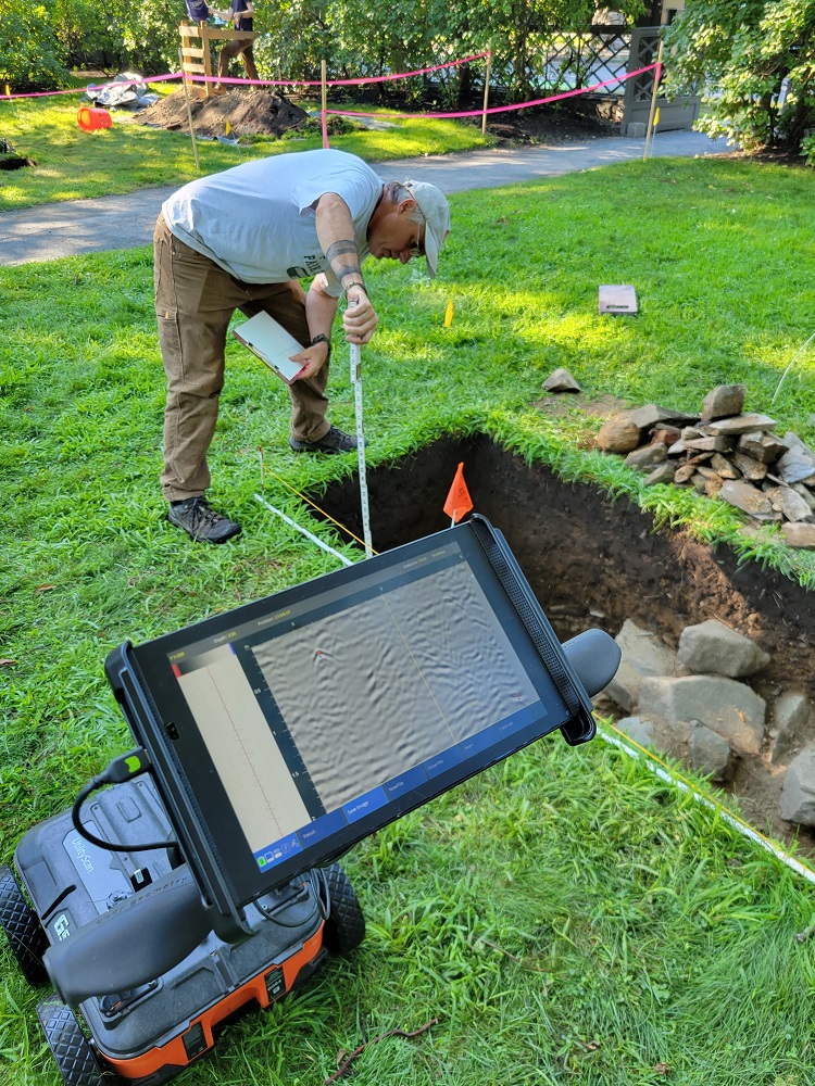
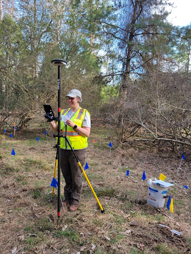
Northeast Archeological Resources Program archeologists on site at (top) Longfellow-Washington's Headquarters with ground penetrating radar and (bottom) Colonial National Park with a Global Positioning System unit. Photo credit: Meg Wilkes (National Park Service).
Disclaimer: Any use of trade, firm, or product names is for descriptive purposes only and does not imply endorsement by the U.S. Government.