
Ice wedges are a common feature of permafrost regions that form when cracks in frozen ground are filled by ice. Because they are located near the ground surface and have little covering insulation, they are susceptible to thaw and can be an early warning sign of permafrost loss. Ice wedges are also responsible for much of the unique polygonal patterned ground in the Arctic. The National Park Service (NPS) Arctic Inventory and Monitoring Network (ARCN) monitors ice wedges using remote sensing at three study areas located in northern Alaska National Park units (Noatak National Preserve, Kobuk Valley National Park, and Bering Land Bridge National Preserve). Researchers monitor ice wedge degradation by analyzing the presence and location of small ponds that form in depressions left behind when wedges melt. Comparison of images from around 1950 (aerial photographs) with high-resolution satellite images from 2006–2009 (IKONOS) and 2019–2020 (WorldView-2) showed substantial degradation in one study area (Kobuk Valley National Park) between 1950 and 2006–2009, but little new degradation in any of the areas between 2006–2009 and 2019–2020. This observation was surprising given record warm temperatures in the study area during 2014–2019. Preliminary findings suggest that recent warming did not force the ice wedges to cross any thresholds that would trigger immediate and widespread visible changes; however, smaller-scale changes like new drainage channels continued to appear. In one instance, new channels connected pits from previous ice wedge degradation and contributed to the drainage of a lake in the Noatak National Preserve study area. The associated project description can be found here.
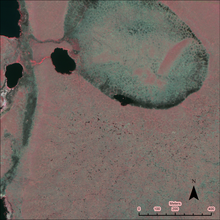
Ice wedge polygons in the Noatak National Preserve, Alaska. A drained lake with low-center polygons is visible in the northern part of this IKONOS image (July 3, 2007). High-center ice wedge polygons with numerous ponds due to degradation of ice wedges are visible in the bottom half of the image. In this color-infrared color scheme, green vegetation appears red and water is black.
Disclaimer: Any use of trade, firm, or product names is for descriptive purposes only and does not imply endorsement by the U.S. Government.