One problem with using divers or remotely operated vehicles to perform underwater inspections of hydraulic structures is that frequently-encountered conditions of poor visibility increase the inspection time and reduce the inspection quality. Commercially available scanning sonar systems can be used to overcome this limitation because sonar works in even highly turbid water to produce detailed images of underwater infrastructure. Scanning sonar can also collect survey-grade bathymetry and three-dimensional (3D) point clouds of underwater features. Point cloud data can be used to develop 3D computer models or to compute estimates of lengths, areas, or volumes. Typical scanning sonar applications include inspections of scour, undercutting, concrete abrasion, exposed rebar, and accumulation of sediment around or debris on intakes. A scanning sonar system is currently being used for a variety of BOR projects, which is critical for developing experience with sonar operation and interpretation of sonar images. This experience includes developing deployment techniques for inspecting features unique to large hydraulic structures such as embankment and concrete dams. The first few applications revealed the need to upgrade the sonar system with accessories to improve data quality, data collection efficiency, and the quality of geographic position data. A recent Department of the Interior Dam Safety Program technology development project was completed to upgrade the scanning sonar sensors and to document various applications of the new technology.
http://www.usbr.gov/pmts/hydraulics_lab/

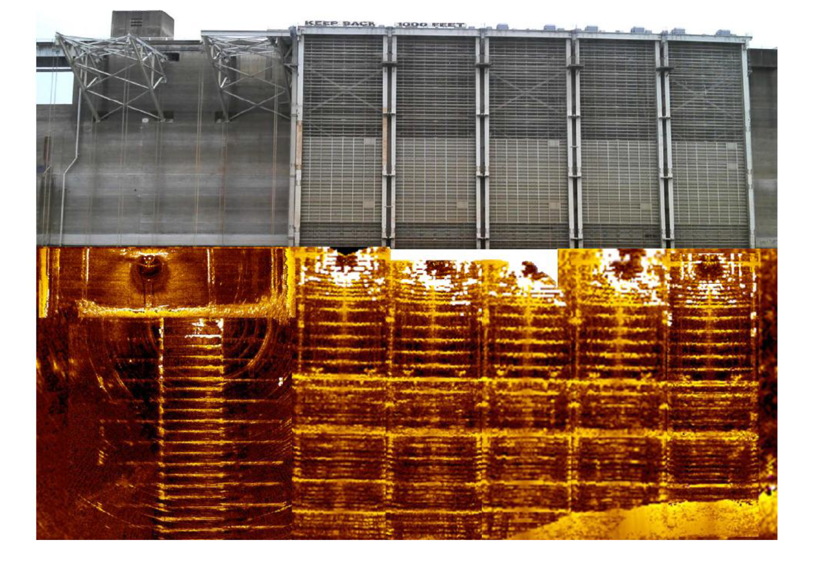
Photograph of the Shasta Lake, California temperature control device (looking at the dam face) with a scanning sonar mosaic of the submerged structural features, August 2014.

