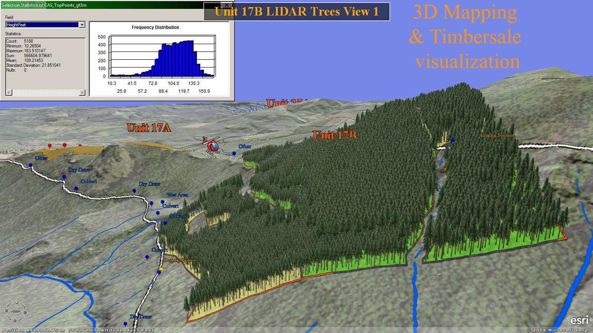
The Cascades Field Office in the Salem District BLM in Oregon has embraced the the power of light detection and ranging (lidar) data for creating 3D visualizations of timber, recreation, and other projects. By creating a point feature class in Esri ArcGIS with height attributes derived from lidar, BLM personnel are able to model individual trees in a project area to create a realistic perspective of the ground-level scenario. These visualizations provide information about and a view of the landscape akin to a field visit, making them useful for conceptualizing project plans for internal team members, managers, cooperators, and the general public. This method can be used as a live map during meetings, to create 3D snapshot visuals for National Environmental Policy Act (NEPA) documents, or to demonstrate "fly-through" videos of a project. BLM analysts are just beginning to scratch the surface of lidar data applications, as the software is becoming more intuitive and more powerful over time. The utilization of lidar for visualization purposes is a novel and effective way to share project information and demonstrates the BLM’s capacity for technological innovation.

Visualization of a timber project with the forest structure represented by 3D tree models derived from lidar digital surface models. The perspective view is slightly west of north, with a total east-west span in the foreground of about 1/2 mile.

