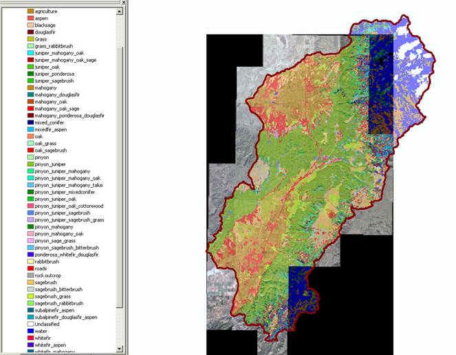
The national-scale BLM Forest Vegetation Information System (FORVIS) provides data about forest attributes and associated land management activities to inform vegetation inventory and monitoring efforts. Remote sensing technology contributes to this program, facilitating a more efficient and complete inventory of vegetative resources, including non-forested land cover types such as shrublands and grasslands. This multi-year BLM project will give the State of Utah comprehensive coverage of all vegetative data, making the inventory useful for a wide range of resource applications. For example, one of the inventory project goals in Utah is to identify areas such as pinyon, juniper, and mixed conifer stands that are suitable for biofuel production.
The Cedar City Field Office area has been the starting point for the inventory, which includes 22.9 million acres managed by the BLM in Utah. The process of converting disparate FORVIS data layers to meaningful land cover information involves the analysis of field and remote sensing data in Trimble eCognition software, which assigns pixels to vegetation categories based on their spectral properties and spatial arrangements. The remote sensing data layers leveraged include 1-m National Agricultural Imagery Program (NAIP) aerial photography, 5-m digital elevation model (DEM) data, and derived slope and aspect products. Field data are collected specifically for this project as well as assembled from multiple additional sources, including existing datasets compiled during other BLM projects, online data portals, and U.S. Forest Service Forest Inventory and Analysis (FIA) data.
Supervised classifications are iteratively performed in eCognition until an acceptable threshold accuracy is reached, at which point the data are entered into the national FORVIS database. Once the Cedar City area is complete, the focus will shift repeating the process for the Vernal Field Office area.
http://www.blm.gov/nstc/resourcenotes/respdf/RN48.pdf

Example of an image classification using the FORVIS classification schema.

