The BLM uses Google Earth Engine (GEE) to leverage remote sensing data for resource management across multiple geographic scales. GEE provides a cloud computing architecture for accessing, processing, analyzing, and generating products from satellite imagery and other geospatial scientific datasets. An extensive image archive, including Landsat, MODIS, Sentinel-1, and Sentinel-2, is available for analysis within GEE. Using GEE, the BLM can efficiently mine available moderate-resolution remotely sensed time series information for a geographic point, field plot, allotment, or any other spatial unit to help address key science questions pertaining to phenology, land cover type, and condition.

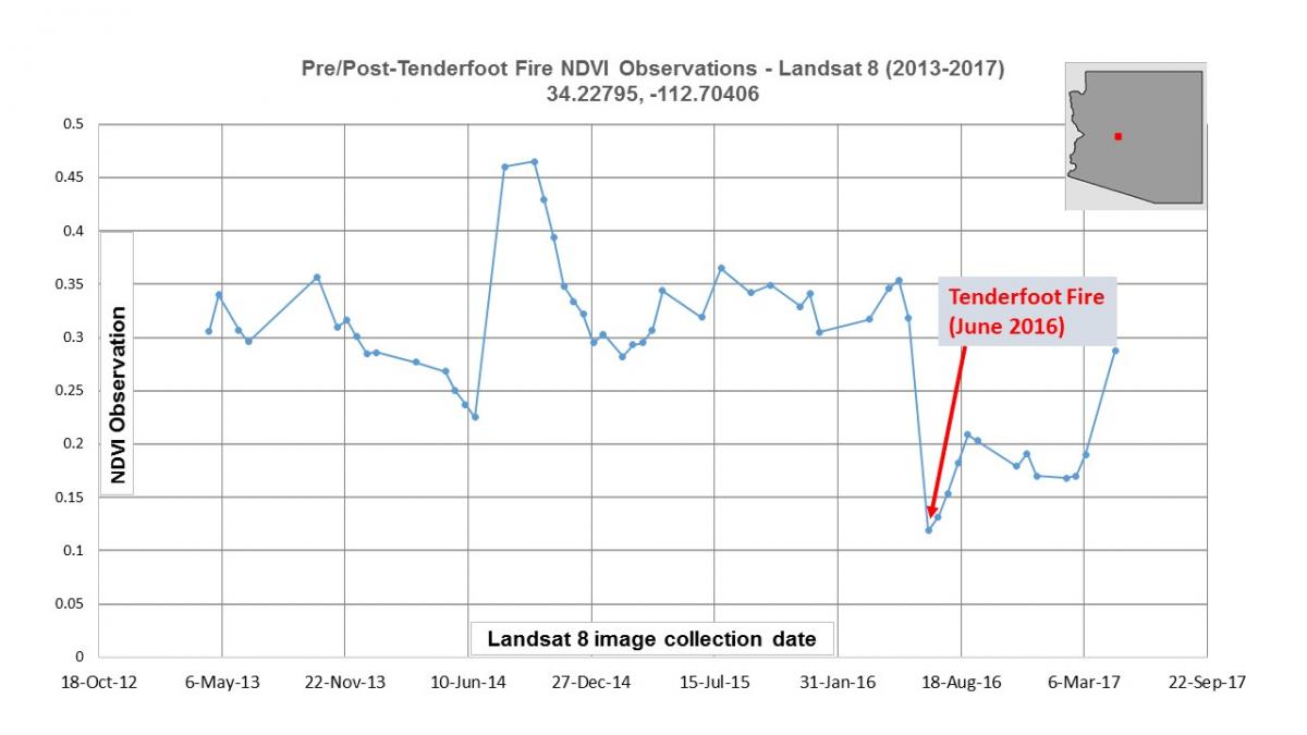
Google Earth Engine was used to produce this time series profile of Normalized Difference Vegetation Index (NDVI) information, derived from Landsat 8 data collected from 2013 to 2017. NDVI is used to identify the presence and health of vegetation cover. Decreases in NDVI value over time can indicate a disturbance to vegetation. This profile reveals the dramatic decline in NDVI values immediately following the Tenderfoot Fire in Arizona, as well as the vegetation recovery seen in early 2017.

