
Current and accurate wetland maps are required for a variety of uses. Individual land owners, non-profit organizations such as Ducks Unlimited, local governments, and state and Federal governments use wetland maps regularly to help plan for land management, development, and restoration. Wetland permitting, environmental impact statements, and transportation planning processes are more efficient and cost-effective if there are current and accurate wetland maps.
At the end of 2018, the Minnesota Department of Natural Resources (MN DNR) will finish an 8-year project to remap every wetland in Minnesota under the leadership of Dr. Steve Kloiber (steve.kloiber@state.mn.us). Through a multi-million-dollar grant from the Environment and Natural Resources Trust Fund, the state acquired high-resolution spring, stereo, statewide aerial digital imagery in addition to funding for remapping of the wetlands. Through a separate program, statewide lidar and derived products were also acquired and used as part of this wetland mapping program. Research and development work from many of the ancillary datasets came from the University of Minnesota and the MN DNR Resource Assessment Group.
Map production under contract was done by Ducks Unlimited using a semi-automated image object approach and by St. Mary’s University using a traditional heads-up digitizing approach. Limited grant assistance, technical assistance, and mapping protocols were provided by the FWS National Wetland Inventory Program. Once stitched together in 2019, this wetland map will represent one of the largest polygonal, topologically structured datasets in the country providing a detailed view of wetlands as small as 0.5 acre representing more than 100 types of wetlands across the entire state.
Wetland functions such as flood storage, wildlife habitat, carbon storage, groundwater recharge, and water quality help protect and restore the landscape. These attributes were added to the wetland maps to provide wetland functional assessments.
https://www.dnr.state.mn.us/eco/wetlands/nwi_proj.html
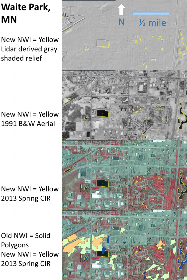
New National Wetland Inventory (NWI) map delineations for Waite Park, Minnesota, overlain on different aerial backgrounds, as noted.