
FWS National Wildlife Refuges (NWR) that contain impoundments used to provide shorebird and waterbird habitat are required to report on the available habitat area by depth class as the water levels change in the impoundments during the migration seasons. At the Alligator River NWR, North Carolina, U.S. Geological Survey QL2 quality lidar data from the 3DEP Program were used to calculate habitat areas by water depth for the impoundments on the refuge at different water levels.
The 5-foot resolution digital elevation model (DEM) data were combined with polygons of impoundment extent. The DEM data were virtually filled within each polygon at different elevations using the GRASS GIS r.lake command. The depth data were then classified to the standard depths given in the FWS National Protocol Framework for the Inventory and Monitoring of Nonbreeding Waterbirds and their Habitats, http://ecos.fws.gov/ServCatFiles/Reference/Holding/40341. Statistics were calculated for each impoundment at each water level and saved to a text file. This process was automated using the Python scripting capabilities in GRASS GIS.
Using 3DEP lidar with this method to determine water depth classes provides more precise habitat information than was previously possible and makes the process more efficient. Future work involves creating a generic Python graphical user interface for the process and expanding to other NWRs as additional lidar data become available. As refuges obtain accurate bathymetric data for their impoundments coinciding with accurate water-level monitoring, improved habitat data can be provided to the Integrated Waterbird Management and Monitoring (IWMM) program.
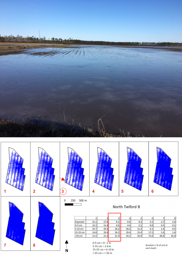
North Twiford B Impoundment, Alligator River NWR: percentages of habitat class by water depth.