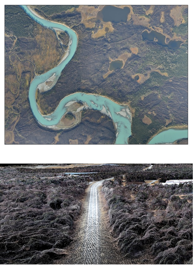
In 2014, a 220,000-acre fire burned within the Kenai National Wildlife Refuge, Alaska. To assess the impact of the fire, new high-resolution orhophotography and elevation data were desired for at least part of the burn. However, acquiring these products using lidar and traditional photogrammetry would be cost prohibitive. Instead, the FWS created high-resolution orthophotographs and a corresponding digital surface model of the entire burn for a relatively low cost using a process involving Structure from Motion (SfM), which is a technique that relies on two-dimensional image sequences to create three-dimensional surface representations. Overlapping photos of the entire area were acquired using a digital SLR camera (Nikon D800) in less than 16 hours of flying time in a fixed wing aircraft. Precise aerial control of the camera position was collected using a Trimble R7 GNSS receiver. A surface point cloud and orthophotographs were created using Agisoft Photoscan software. The average pixel size or ground sample distance (GSD) was approximately 15 cm. For consistency and file size considerations, scientists created orthophotographs and a corresponding digital surface model with a GSD of 20 cm. Without ground control, horizontal positional accuracy was less than 2 m. With only a few ground control points placed within the collection areas of up to 30,000 acres in size, it was possible to obtain horizontal and vertical positional accuracy of less than 10 cm, which was well within the GSD. These data will be used as baseline information to quantify erosion and revegetation in the burn area.

Sample orthophotograph and point cloud.

