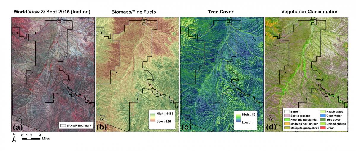
The 48,000-ha Buenos Aires National Wildlife Refuge (BANWR) was established in 1985 for the re-introduction of the critically endangered masked bobwhite quail (Colinus virginianus ridgwayi) to semidesert grasslands. Since that time, prescribed fire has played an important role in vegetation management at BANWR, burning 1,000 ha/yr or more. The Joint Fire Science Program-funded project “Determining Prescribed Fire and Fuel Treatment Compatibility with Semidesert Grassland Habitat Rehabilitation for the Critically Endangered Masked Bobwhite Quail (Colinus virginianus ridgwayi)” has sought to understand the impact of prescribed fire history on quail habitat. To analyze fire effects on habitat, FWS researchers measured 446 20-m x 50-m vegetation plots within fire frequency strata between 2012 and 2015, recording plant species composition, structure, and herbaceous plant biomass (fine fuels). One of the principal objectives of this research was to “scale-up” plot-level measurements to map vegetation characteristics for assessing habitat and hazardous fuel conditions across the refuge. Worldiew-3 (WV3) imagery was acquired for BANWR in both September (peak vegetation greenness) and November (senesced/dormant vegetation) of 2015 in addition to 2014 and 2015 Landsat 8 imagery for these same phenologic stages. All image data were rigorously geometrically and radiometrically corrected using a standardized image processing workflow. Random Forest (RF) and regression tree classifications were used to develop a suite of image-based vegetation products. The final products include a land cover map based on plant life forms, fine fuels biomass (kg/ha), tree, woody, herbaceous, and bare-ground percent cover as well as a more detailed vegetation map using life form and National Vegetation Classification (NVC) alliance-level categories.
Classification accuracy of the land cover map is 80% at a 10-m pixel size. The fine fuels biomass map developed using RF regression models explained 59% of the variation with multi-date WV3 imagery and 62% of the variation with multi-date Landsat 8 imagery. These data layers are being used in conjunction with habitat suitability model functions to determine the best locations for releasing captive-raised masked bobwhite, in addition to understanding how prescribed fire has played a role in developing habitat conditions on the refuge.

Example data products include a) orthorectified WorldView-3 satellite image, b) fine fuel biomass, c) woody plant cover (trees and shrubs), and d) vegetation cover classes.

