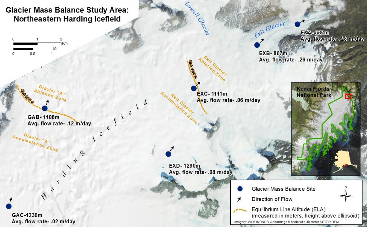
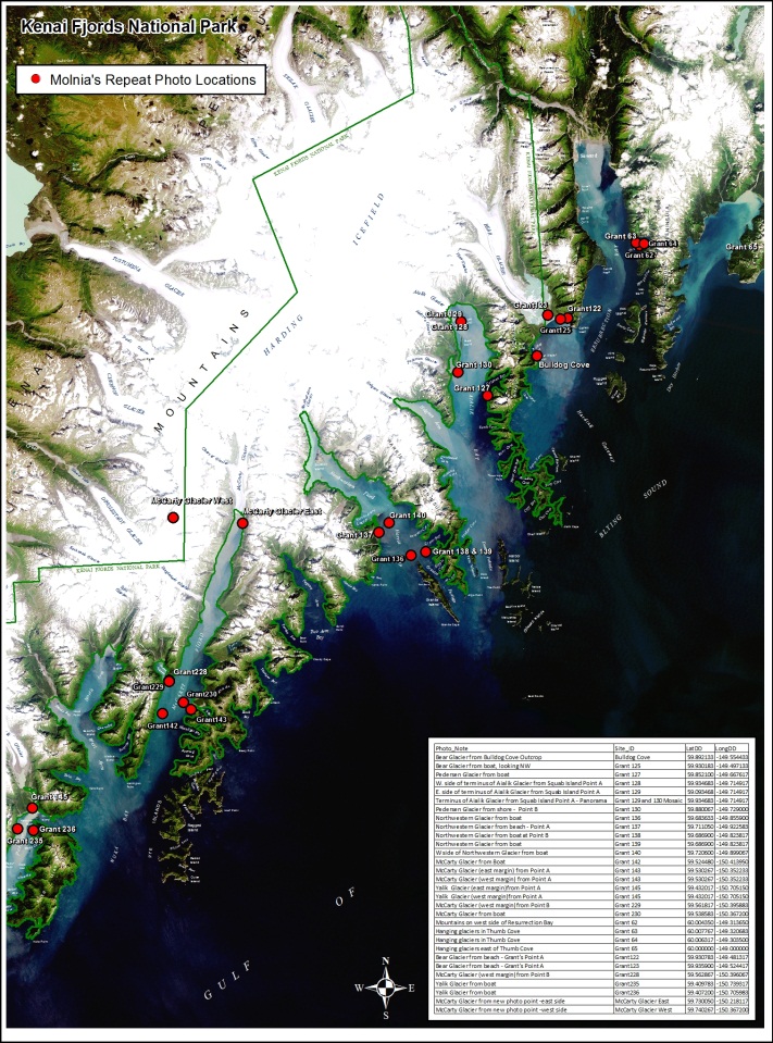
In 2012, GPS and GIS remote sensing technologies were vital tools used for resource management in Kenai Fjords National Park (KEFJ). As part of an ongoing glacier monitoring effort, KEFJ staff used Trimble GPS to navigate to and update mass balance stake locations and to assess flow velocity of the Harding Icefield (see figure below showing Harding Icefield). GPS, GIS, and remote sensing are also used to document the location of photo points for a repeat photography project documenting landscape change in KEFJ and to map the retreat of the Exit Glacier (see figure below showing Molnia’s repeat photo locations in Kenai Fjords National Park). The Exotic Plant Management Team uses GPS, GIS, and remote sensing to map and monitor nonnative plant populations.
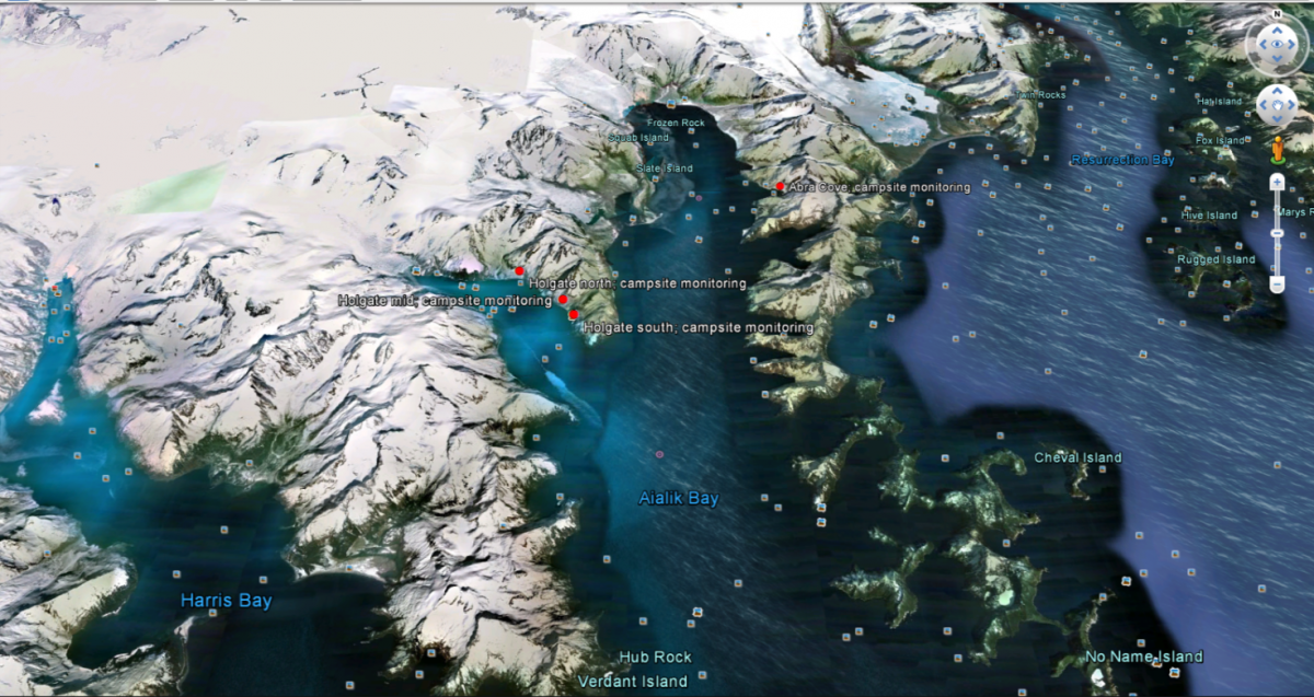
GIS and remote sensing technologies were used to enhance the new resource management blog called “Kenai Fjords in the Field.” The blog provides updates of researchers’ activities throughout the field season and web-links to kml or kmz files viewable in Google Earth to provide a spatial component to the posts and allow readers to see where research is being conducted (figure below).
Managers used GPS to map and monitor backcountry campsites on the outer coast. GIS and satellite imagery (IKONOS and Landsat) were used to identify soil sampling locations for upcoming soils mapping field work. GPS was also used to map structures and other facilities in the park for more comprehensive management of the park’s infrastructure.
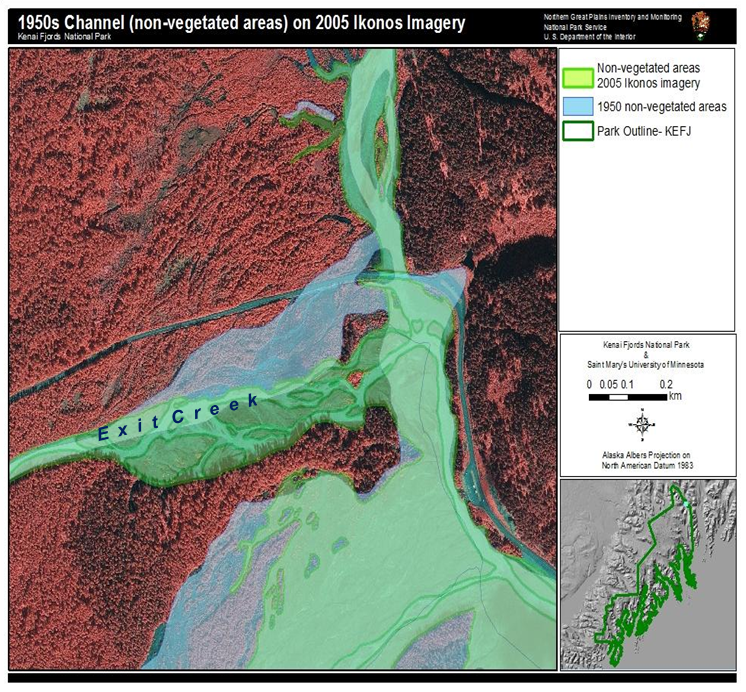
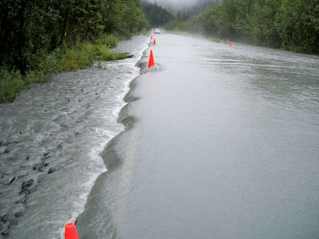
Staff at KEFJ worked with St. Mary’s University through a Cooperative Ecosystems Studies Unit (CESU) agreement to digitize historic channels on Exit Creek (figure below) in an effort to understand recent creek behavior resulting in midsummer floods (figure below).
GPS is used to locate sites and track stakes for the glacier mass balance monitoring project over the Harding Icefield.
GPS and GIS are used to document the location of photo points for a repeat photography project documenting landscape change in the park
KEFJ resource managers linked to Google Earth from their blog to illustrate locations of research in the park.
A preliminary view of historic Exit Creek channel positions digitized based on historic aerial photographs and imagery for Kenai Fjords National Park.
Summer flooding on Exit Glacier Road, near Seward, Alaska. August 16, 2010.


