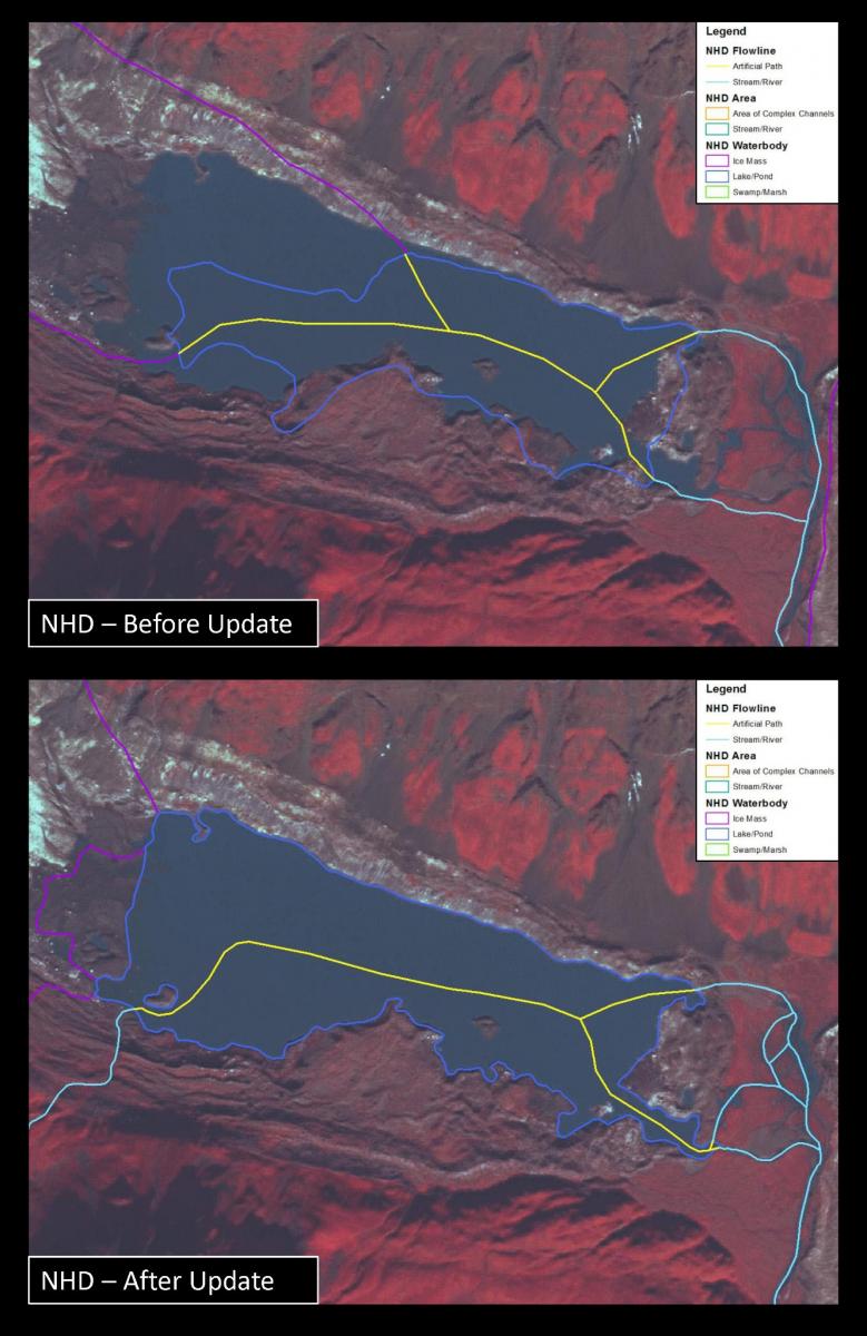
The NPS Alaska Regional Office GIS team has been using the newest Satellite Pour l'Observation de la Terre (SPOT) 5 satellite imagery to update hydrography features in the NHD within Denali National Park and Preserve. The NHD is the surface water layer of The National Map, which contains features such as lakes, ponds, glaciers, streams, rivers, canals, dams and stream gages. Much of the current NHD in Alaska was derived from original USGS topographic mapping based on 1950s aerial photography and compiled at a scale of 1:63,360. Compared to current imagery and spatial layers that are derived from more recent mapping efforts, the older data contain positional inaccuracies and cartographic inconsistencies (e.g. disconnected rivers, streams flowing uphill, displaced waterbodies, etc.). Given the natural changes in surface hydrology due to the dynamic nature of water flow and the accelerating influence of the changing climate, updating the original NHD for Alaska is a key mapping priority.
The Statewide Digital Mapping Initiative (SDMI) for Alaska is providing datasets that are key for updating the NHD layer in The National Map: SPOT 5 satellite imagery with a 2.5-m resolution (see figure showing NHD coverage), digital elevation models with a 5-m resolution (IFSAR) and a range of derivative products. These recent spatial data acquisitions will allow comprehensive revision of the Alaska NHD layer.
Before and after comparison of NHD data over current SPOT5 satellite imagery


