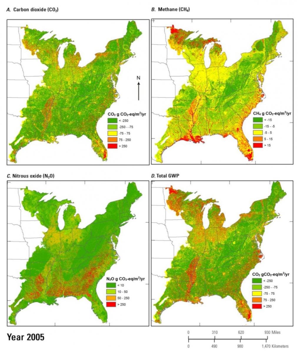
As part of an effort to fulfill the requirements of section 712 of the Energy Independence and Security Act (EISA) of 2007, the USGS is conducting a comprehensive national assessment of potentials for carbon (C) sequestration and reduction of greenhouse gases (GHGs) emissions (CO2, CH4, and N2O). This assessment covers all major terrestrial ecosystems (forests, grasslands/shrublands, agricultural lands, and wetlands) and aquatic ecosystems (rivers, streams, lakes, estuaries, and coastal waters) from 2001 to 2050 in the eastern United States.
Like two previous regional assessments -- Great Plains and the western United States -- this project applies the General Ensemble biogeochemical Modeling System (GEMS) to simulate ecosystem biogeochemical cycles, including carbon stock and fluxes and GHGs emissions under various land use / land cover change and climate change scenarios. The scenarios were developed in accordance with storyline A1B, A2, or B1 from the Intergovernmental Panel on Climate Change Special Report on Emissions Scenarios (http://www.grida.no/publications/other/ipcc_sr/?src=/climate/ipcc/emissi...). More detailed information on the Assessment of Carbon Sequestration Potentials in the Eastern United States can be found in U.S. Geological Survey Professional Paper 1804 by Z. Zhu and B.C. Reed, editors, 2014, (http://dx.doi.org/10.3133/pp1804).

Lui – LandCarbon graphic
Maps showing the spatial distribution of the average annual carbon dioxide, methane, and nitrous oxide fluxes and their total global warming potential (GWP) from 2001 to 2005 in the eastern United States.

