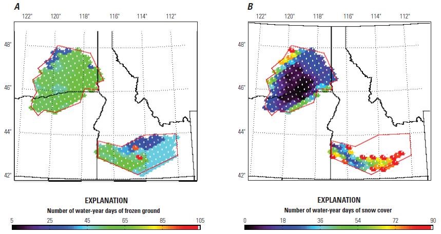
Seasonally, frozen ground covers approximately one‑third of the conterminous United States, causing increased winter runoff and reduced potential groundwater recharge. The temporal and spatial distribution of frozen ground is expected to change as the climate warms. The USGS Groundwater Resources Program combined satellite remote sensing and ground truth measurements to investigate seasonally frozen ground and recharge at local to regional scales in the Columbia Plateau, Washington and Oregon, and the Snake River Plain, Idaho. The frozen-ground/snow-cover algorithm from the National Snow and Ice Data Center, combined with the 21-year record of passive microwave observations from the Special Sensor Microwave Imager onboard a Defense Meteorological Satellite Program satellite, provided a unique time series of frozen ground data. This methodology can be used to monitor and identify regional changes to frozen ground that could occur with a warming climate. A precipitation-runoff model simulated recharge for several future climates and frozen ground scenarios. Existing index-based frozen-ground algorithms in the model provided a means to estimate what might occur under future climate scenarios, but more detailed energy-balance models of frozen-ground hydrology are needed to accurately simulate recharge under seasonally frozen ground.
http://pubs.er.usgs.gov/publication/sir20145083

Satellite remote sensing data for (A) frozen ground and (B) snow cover, Columbia Plateau and Snake River Plain, water year 2006 (defined as the period from October 1, 2005 to September 30, 2006).

