
High-resolution hydrographic mapping, which provides essential data for flood mitigation and planning, has been completed on thirteen, 12-digit hydrologic units near Sioux Falls in southeastern South Dakota. A lidar-derived digital elevation model was processed to include culvert locations into the modeled drainage network. Culverts were identified from existing inventories and by using selective drainage processing that identifies additional likely culvert locations, which were subsequently verified using high-resolution aerial imagery or field inventories. Geospatial data layers for the culverts, the raw and hydro-enforced elevation models, and other flow derivative layers have been released on ScienceBase at https://doi.org/10.5066/F7ZG6RGS. Twelve-digit watershed boundaries developed from the hydro-enforced elevation model will be used to update the Watershed Boundary Dataset, and 14-digit boundaries will be added as well. The lidar-based drainage network will also be compared to existing flowlines in the National Hydrography Dataset to identify areas where streams may need to be updated. The products of this study will provide resource managers and urban planners with better detail and a more current picture of hydrographic features within the study area.
https://sd.water.usgs.gov/projects/HighResMapping/HighResMapping.html
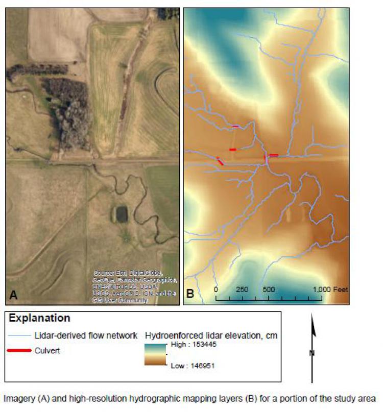
Imagery (A) and high-resolution hydrographic mapping layers (B) for a portion of the study area in southeastern South Dakota.