
The Northern Rangelands Trust (NRT) is an umbrella organization of 33 community conservancies that stretch across the arid and semiarid landscape of northern Kenya. The NRT conservancies protect iconic species such as elephants, rhino, giraffe, cheetah, Grevy’s zebra, hirola, and oryx while supporting a pastoralist, livestock-dominated region in which people’s livelihoods depend on access to grazing areas.
Following the intent of the 2016 Memorandum of Understanding (MOU) with NRT signed by former Secretary of the Interior, Sally Jewell, the U.S. Department of the Interior’s International Technical Assistance Program (DOI-ITAP) partnered with the U.S. Agency for International Development (USAID/East Africa) to leverage DOI expertise in support of NRT needs. In 2017, a fact-finding team of DOI experts identified that NRT’s top need is to develop remote rangeland condition monitoring in order to quickly assess changes in condition and take grazing management action.
Although rangeland monitoring at 250 meters (m) or greater with the MODIS sensor is functioning, NRT needs additional mapping that more precisely captures the high compositional and spatial complexity and sparsity of ground cover (grasses and weeds) for responsive management. To answer that need, the USGS is creating a mapping technology based on 10-m Sentinel-2 optical data and augmented with 10-m Sentinel-1 radar data. Greater spatial resolution will vastly increase the separation of highly scattered to dense trees from grass and weed ground cover, and greater spectral information will better detect and track occurrences of live vegetation. Both spatial and spectral increases will substantially boost the value of the produced maps for grazing management.
Field data collections were carried out in the central NRT near the end of the rainy season in mid to late June 2018. These data are being processed by the USGS for calibration and assessment of accuracy and limitations in mapping the grass and weed occurrence and live composition. Image data acquired near-concurrently with field collections are being processed and mosaicked to provide maps of NRT.
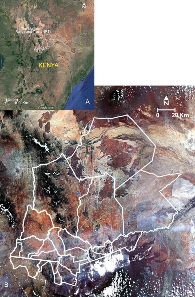
(A) Location of NRT in Kenya. (B) Mosaic of nine Sentinel-2 optical images acquired on June 8 and June 18, 2017, depicted as a natural color composite covering the NRT core area. The image composite will be transformed to estimated occurrences of live vegetation with calibration equations calculated with field and near concurrent image data collections. Tree occurrences will be estimated within the constraints of the 10-m image data and a tree occurrence map will be created. The tree occurrence map will be overlain on the live vegetation map to produce a map representing the estimated occurrence of ground cover live vegetation and percent cover.