
Approximately 90% of the naturally occurring wetlands in California’s Central Valley (including the Sacramento-San Joaquin Delta) have been lost due to land use change, yet the area remains a critical landscape for migratory waterbirds through a complex system of managed wetlands and post-harvest flooded agriculture. USGS researchers are working with The Nature Conservancy, the California Landscape Conservation Cooperative, and the U.S. Fish and Wildlife Service to prioritize the timing and location of water allocation to Central Valley croplands and wetlands to optimize habitat for migratory birds and the giant garter snake. As part of this project, the team is generating Central Valley-wide Landsat-based time series maps (2007–2017) of waterfowl food resource (moist soil seed) extents and relative productivity derived from Normalized Difference Vegetation Index greenness metrics. Valley-wide estimates of waterfowl food resources are needed to run bioenergetics models that support conservation planning. Given the extreme fluctuations in water availability, maps will also provide an annual record of how wetlands were managed.
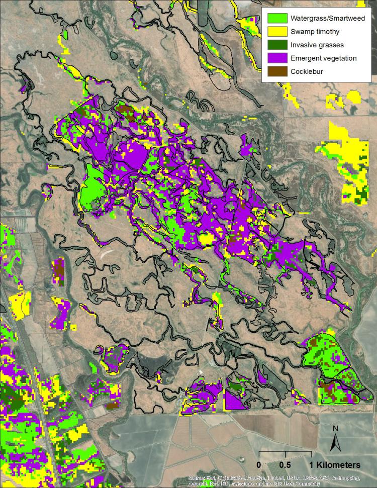
2017 map of managed wetland vegetation, including moist soil seed plants (watergrass, swamp timothy and smartweed) at the San Luis National Wildlife Refuge, California.