
Vegetation structure is a key attribute of forested ecosystems, influencing habitat suitability, water quality and runoff, microclimate, and wildfire behavior. The Fire-Science Team at the USGS EROS Center is fusing spaceborne lidar and passive optical data to create spatially complete maps of vegetation structure at 30-meter resolution. These maps will allow land managers to make informed decisions and provide key inputs to fire simulation models.
The Global Ecosystem Dynamics Investigation (GEDI) is a lidar instrument aboard the International Space Station that makes direct observations of the vertical structure of vegetation on the Earth’s surface. GEDI is a sampling mission, illuminating sparsely distributed 25-meter diameter footprints. The spatial sparsity of GEDI motivates the fusion of spatially complete optical data from Landsat 8. The optical bands of Landsat 8 are correlated with the vegetation variables of interest, allowing statistical models to learn this correlation where GEDI and Landsat 8 overlap and then make predictions where Landsat 8 data are present but GEDI data are not. In addition, the inherent spatial correlation of the GEDI observations can be used to interpolate variation in vegetation structure not explained by the Landsat 8 optical bands. The result is a statistical modeling procedure that produces spatially complete maps of vegetation structure at the 30-meter resolution of Landsat.
The ability of the procedure to map canopy height was tested across the Black Hills of South Dakota, an area with coarsely varied canopy structure. Test data consisting of 10% of the GEDI observations within the Black Hills were withheld and predicted with the remaining GEDI observations in addition to Landsat imagery of the area. The method predicted canopy height with a mean absolute error of 0.84 m, demonstrating accurate prediction. A complete map of canopy height for the entire Black Hills was then generated.
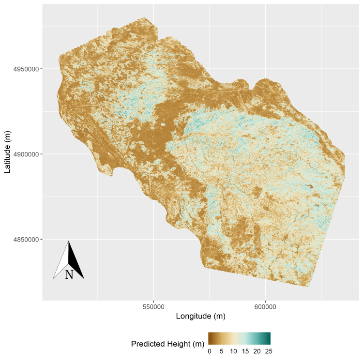
Predictions of canopy height at 30-meter resolution across the Black Hills, South Dakota.