
Approximately 2 billion people are expected to experience diminished water supplies because of seasonal snowpack decline this century. Over the last 50 years, particularly in some regions of the western U.S., declines in annual snowpack levels have contributed to reduced streamflow levels, a trend supported by both models and in situ observations (USGS, From Snow to Flow).
The USGS Water Resources Mission Area teamed with the National Uncrewed Aircraft Systems Project Office (NUPO) to collect Uncrewed Aircraft Systems (UAS) lidar point cloud data (LPC) to calculate centimeter-level snow depth measurements. These data are part of a broader study to measure the snow-water equivalent of watersheds as part of the USGS Next Generation Water Observing System.
The USGS field team conducted three separate UAS data collects over the Winter Park, Colorado, study site in September 2020, February 2021, and April 2021. The team flew a UAS equipped with a lidar payload and surveyed ground-based targets for control and accuracy validation. A bare-earth digital elevation model and a snow-surface model (vegetation removed) were generated from the LPC data. Snow-depth maps were generated by subtracting the bare-earth terrain from the snow-surface model.
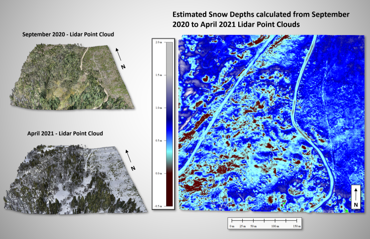
Images show the lidar point cloud acquisitions in Winter Park, Colorado for September 2020 (upper left) and April 2021 (lower left) and the derived map of snow depths (right).