
Phragmites australis is a tall, perennial reed that is the lynchpin of the Mississippi River Delta ecosystems. The sudden dieback of P. australis stands beginning around 2016 caused alarm and initiated multi-year satellite mapping of Normalized Difference Vegetation Index (NDVI) to track the relative condition of remaining populations. To link cause or causes of dieback captured by satellite data required that a quantifiable ground-based condition index be identified and calibrated to the satellite-based NDVI. In cooperation with the U.S. Fish and Wildlife Service, this study implemented a field procedure for simultaneously measuring the live leaf fractional cover (LFC) and spectral reflectance of the 3- to 4-meters tall P. australis marsh within a large spatial target (approximately 4.5 m). Using the spectral frequency response of the 10-meter Sentinel-2 data (closely aligned with 30-meter Landsat), the field spectral reflectance was transformed to field-NDVI that was directly related to field-LFC. The field-NDVI was then used to calibrate the 2018 fall and 2019 summer Sentinel-2 NDVI images to field-LFC. The similarity of overlapping Sentinel-2 and Landsat LFC maps provided LFC calibration which could be applied to transform Landsat images to LFC maps.
Annual, and in some cases seasonal, P. australis LFC maps were created of the lower Mississippi River Delta from 2009 to 2019. The mapping concluded that the infestation of a non-native scale insect, which was widely believed to be responsible for the dieback, was likely not the sole cause. The LFC maps provide direct quantitative assessment of spatial changes at a single date (status) and spatial and temporal changes over time (trends) at the pixel level (Sentinel-2 from 2016 to 2019 and Landsat from 2009 to 2016). The calibration procedure of field capture of LFC and direct linkage to field-NDVI and ultimately satellite-NDVI and the formulation of a mapping calibration dataset that ranged from summer to late fall (approximately 20% to 100% LFC) for quantitative mapping of P. australis condition are critical developments of this study.
https://doi.org/10.3133/ofr20201131
https://doi.org/10.5066/P9ASPB4E

The calibration between the field NDVI calculated from field reflectance data and webcam LFC classifications.
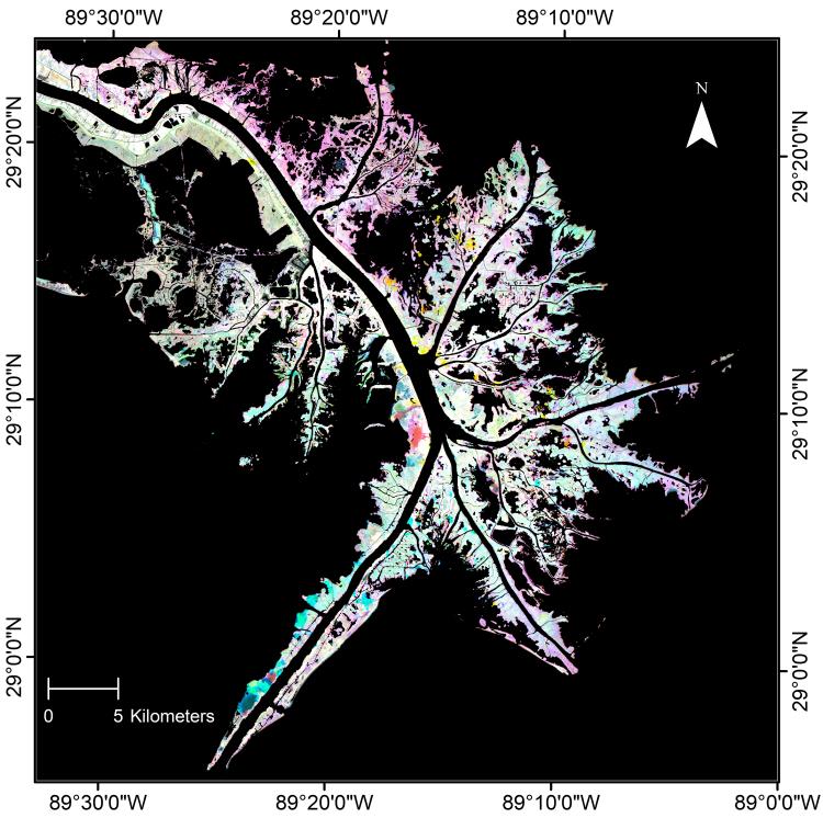
Sentinel-2 LFC color composite displaying the 2016 LFC as red, 2017 LFC as green, and 2018 LFC as blue for the lower Mississippi River Delta, Louisiana.