
The U.S. Geological Survey (USGS), in collaboration with the Bureau of Ocean Energy Management (BOEM), the U.S. Fish and Wildlife Service (FWS), and Dr. Stella Yu’s research group at the University of Michigan, is advancing the development of machine learning algorithms to detect and classify seabirds, waterfowl, and other marine wildlife from digital aerial imagery. Improved sensor, computing, and image processing technologies can enhance the safety, cost efficiency, and quality of derived data for wildlife population surveys used by natural resource management agencies. Initial machine learning algorithm development has achieved the extraction of targets (individual birds and other wildlife) from imagery; current algorithm development is focused on classifying detected targets to the species level. Algorithm performance based on image and environmental characteristics (such as spectral resolution, background water color, sea state, and cloud cover) is being tested to maximize detection and classification accuracy. This project has involved the development of an online feature annotation tool for easy, streamlined labeling of training data by biologists.
Additional work to store imagery, annotation data, and trained model parameters is currently being developed for online data archiving and sharing. These products are intended to provide baseline information on wildlife distributions, abundance, and seasonal movement to inform migratory bird harvest assessments, environmental assessments, and impact analyses of potential wildlife exposure to offshore energy development projects. The processes, algorithms, and associated tools and databases are intended to be applicable across a range of taxa and environments.
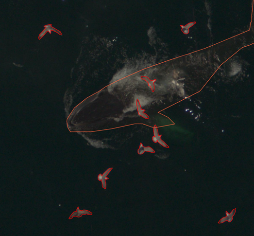
Manually annotated wildlife targets in an aerial image.
Disclaimer: Any use of trade, firm, or product names is for descriptive purposes only and does not imply endorsement by the U.S. Government.