
Accurate maps of seasonal habitat for greater sage-grouse (Centrocercus urophasianus) across broad extents are of paramount importance to conservation efforts in sagebrush ecosystems across the Great Basin, particularly for habitat assessments and mitigation efforts. However, the ability to model sage-grouse habitat at fine spatial scales necessary for microhabitat assessment is constrained by the spatial and spectral resolution of most remotely sensed measurements of vegetation composition. Fractional approaches that scale plot-based measures of vegetation composition to satellite imagery that yield estimates of percent cover at relatively coarse resolution (30-meter pixels) are well suited for regional and local estimates of macrohabitat (3rd order) selection and availability, but precision at individual pixels that could represent microhabitat (4th order) selection and availability is often poor. As a continuation of previous shrub mapping efforts, the U.S. Geological Survey Western Ecological Research Center is currently utilizing multispectral imagery from uncrewed aircraft systems (UAS) collected by the Center for Transformative Environmental Monitoring Programs (CTEMPS) at the University of Nevada, Reno, and WorldView satellite imagery from Maxar, Inc. to generate fractional cover maps containing detailed vegetation components. These high-resolution fractional cover maps will identify sagebrush, non-sagebrush shrub, forbs, and grasses. Estimates of vegetation components in training plots derived from ultra-high-resolution (less than 3-centimeter) UAS imagery and object-based image analysis (OBIA) are applied to high-resolution (2-meter) WorldView scenes using regression tree (RT) models. An advantage of the UAS-RT approach is that large volumes of training data can be collected rapidly from UAS compared to traditional ground-based vegetation surveys, which could ultimately generate more reliable estimates of microhabitat availability across macrohabitat or landscape level extents.
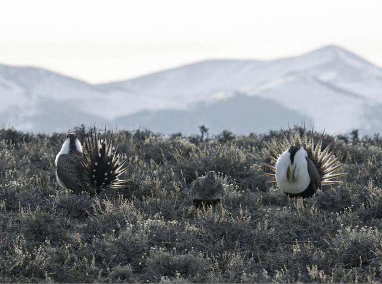
Male greater sage-grouse displaying at lek site near the Ruby Mountains, Nevada. Photo Credit: Tatiana Gettelman, USGS.
Disclaimer: Any use of trade, firm, or product names is for descriptive purposes only and does not imply endorsement by the U.S. Government.