
The island of Puerto Rico is subject to numerous natural hazards including hurricanes, coastal erosion, and flooding. Information on how the island’s coastal environments respond to these events is critical for bolstering coastal resilience. Due to the dynamic nature of the coast, continuous monitoring with remote sensing technology supports rapid assessment of real-time change and maximizes data collection, which may be especially useful to guide critical decisions about emergency preparedness, response, recovery, and threats to economic security.
Scientists at the U.S. Geological Survey (USGS) St. Petersburg Coastal and Marine Science Center recently mounted cameras on Puerto Rico coasts (“Coast Cams”) to record and measure how far the waves reach up the beach as well as how the coast changes in response to waves and storms. The team also installed oceanographic buoys offshore that send back data in real time on wind, waves, and water levels. Remotely sensed data help scientists better understand the processes involved in coastal change, improve the accuracy of water level and coastal change forecasts on the island, and provide these data rapidly to local stakeholders—which is especially important when a storm is approaching. These data are becoming increasingly important with climate change effects such as increased frequency and intensity of tropical storms and hurricanes compounded by the effects of sea-level rise. In a related effort, the project team used satellite data in conjunction with historical imagery to study shoreline change over long- and short-term time scales to help identify areas that are most vulnerable to these changes.
The information derived from remote sensing data can help residents of the territory be more prepared for, and resilient to, these hazards, if the information is findable and accessible to the community. The team worked with other groups across the bureau to compile information on natural hazards and resources relevant to the island and share them via a series of bilingual web pages. Web content is being disseminated to local partners and organizations, including those in historically underserved communities, so they have direct access to USGS science and can make informed decisions when preparing for future natural disasters.
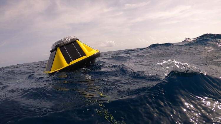
An oceanographic buoy installed offshore in Puerto Rico transmits real-time measurements of wind, waves, and water levels, which U.S. Geological Survey (USGS) scientists use to improve and validate predictive models of coastal change. Photo credit: B.J. Reynolds (USGS).
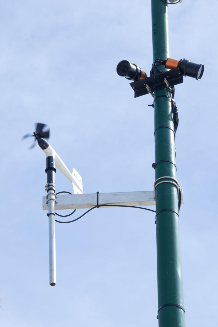
One of several camera systems (“Coast Cams”) along the coast of Puerto Rico that transmits real-time imagery of wave run-up along the beach and coastal response to high water levels and extreme storms. The white equipment is a meteorological station that collects wind and atmospheric pressure data. Photo credit: Mark Buckley (U.S. Geological Survey).
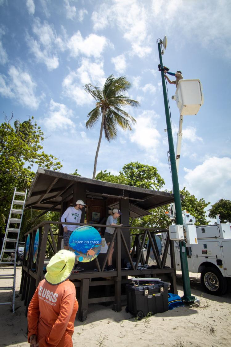
Installation of one of several cameras (“Coast Cams”) along the coast of Puerto Rico that send images in real time to U.S. Geological Survey (USGS) scientists, who monitor and measure wave run-up along the beach and coastal response to high water levels and extreme storms. Photo credit: Priscila Vargas-Babilonia (USGS)
Disclaimer: Any use of trade, firm, or product names is for descriptive purposes only and does not imply endorsement by the U.S. Government.