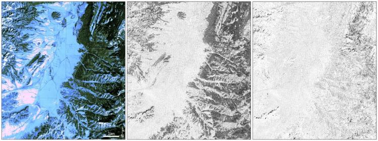
The Landsat Collection 2 Fractional Snow Covered Area (fSCA) science product provides per-pixel fractional snow cover maps that indicate the percentage of pixels covered by snow for Landsat 4–8 data. While Landsat’s acquisition frequency limits analysis of short-term snow cover variations, longer-term changes in snow cover duration and persistence can be detected. Landsat’s spatial resolution also offers the capability to resolve snow cover patterns across topographically complex mountainous regions.
Collection 2 fSCA introduces scene statistics products including mean snow cover fraction and clear pixel count for unique time steps for 1984 to present. These time steps include 5-year date ranges and the entire Landsat U.S. Analysis Ready Data (ARD) stack period. Each fSCA statistic package contains monthly (entire ARD stack only), annual, and mean annual viewable or ground snow cover statistics files for each unique time step, over a single tile location. fSCA statistics for monthly and annual fractions and clear pixel counts are created for 5-year time spans from 1986 to present.
In addition to the statistics, other Collection 2 fSCA improvements include expanding the product to the Midwest and Northeast for the conterminous United States, adding the Aleutian Islands to the Alaska grid, and separating the snow band into a viewable and ground snow band that is adjusted for canopy cover.

Example of the Landsat Collection 2 Fractional Snow Covered Area (fSCA) science product showing an area in Dixie National Forest in Utah on February 28, 2021. Left: Landsat 8 Collection 2 U.S. Analysis Ready Data Surface Reflectance image (Bands 6, 5, 4); middle: fSCA; and right: Canopy Adjusted fSCA.
Disclaimer: Any use of trade, firm, or product names is for descriptive purposes only and does not imply endorsement by the U.S. Government.

