
Landsat Collection 2 Normalized Difference Snow Index (NDSI) data are now available through the U.S. Geological Survey Earth Resources Observation and Science (EROS) Center’s Science Processing Architecture (ESPA) on-demand interface. NDSI is the normalized difference between spectral bands green (G) and shortwave infrared (SWIR). NDSI is useful for separating snow from vegetation, soils, and other spectral signatures, and is delivered as a single band. The probability that snow is present is proportional to how close the NDSI pixel value is to 1 (range –1 to 1). NDSI is derived from Level-2 Surface Reflectance and is available globally for Landsat 4–9. Visit the Landsat Surface Reflectance-Derived Spectral Indices webpage for information on product constraints, citations, and reference information.
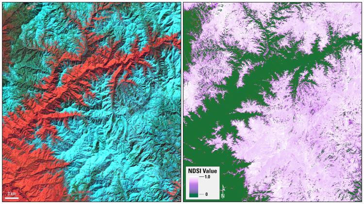
This graphic shows an example of the Landsat Collection 2 Normalized Difference Snow Index (NDSI) in Boise National Forest, Idaho. Left: Landsat Collection 2 Surface Reflectance using the shortwave infrared, near-infrared, and red bands (Bands 6, 5, 4); right: Landsat Collection 2 NDSI.
Disclaimer: Any use of trade, firm, or product names is for descriptive purposes only and does not imply endorsement by the U.S. Government.