
The Landsat Collection 2 Level-3 Dynamic Surface Water Extent (DSWE) product provides raster layers relating to per pixel surface water inundation in Landsat data. Aquatic researchers and land managers who require habitat information can use DSWE to predict and understand impacts due to changes in surface water extent. DSWE provides surface water inundation for Landsat data acquired for the conterminous United States, Alaska, and Hawaii from 1984 to present.
Several improvements were made to the Collection 2 DSWE product. Overall, there is high agreement between Collection 1 and Collection 2 for the high-confidence water class. Some of the changes include using the Collection 2 Digital Elevation Model (DEM) and masking developed urban area from some classes in the interpreted layer. For more information and to learn how to download the DSWE science product, visit the Landsat Collection 2 Dynamic Surface Water Extent Science Product.
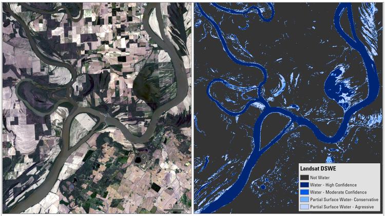
Example of the Landsat Collection 2 Dynamic Surface Water science product showing the confluence of the Wabash and Ohio Rivers on April 12, 2021. Left: Landsat Collection 2 U.S. Analysis Ready Data surface reflectance; right: Dynamic Surface Water Extent.
Disclaimer: Any use of trade, firm, or product names is for descriptive purposes only and does not imply endorsement by the U.S. Government.