
The western United States Gulf of Mexico coast provides important habitat for migrating and wintering waterfowl and shorebirds. The Gulf Coast Joint Venture, comprised of staff from the U.S. Fish and Wildlife Service, the U.S. Geological Survey (USGS), and Ducks Unlimited, is one of 25 migratory bird Joint Ventures in North America and is focused on advancing conservation of priority bird habitats in this region. Gulf Coast Joint Venture scientists develop and use bioenergetic models (for example, models that incorporate species-specific population abundance objectives, temporal residency, daily energy demand of birds, and foraging energy values of habitats) to translate regional avian population targets into quantitative habitat objectives that are expected to represent landscape conditions needed to support populations at desired levels.
The Gulf Coast Joint Venture region encompasses coastal marsh and associated habitats from Alabama to south Texas and is geographically subdivided into six planning units called Initiative Areas: Coastal Mississippi-Alabama, Mississippi River Coastal Wetlands (Louisiana), Louisiana Chenier Plain, Texas Chenier Plain, Texas Mid-Coast, and Laguna Madre (Texas). Across this region, USGS and Gulf Coast Joint Venture scientists use remote sensing to estimate the amount of avian habitat in seasonally flooded wetlands and agricultural lands. Specifically, assessments are conducted annually for wintering waterfowl (August 16–March 31) and fall migrating shorebirds (July 15–November 5). Using Landsat imagery, the waterfowl habitat assessments include the delineation of open shallow water, flooded grasslands, and temporarily flooded wetlands, collectively, whereas the shorebird assessments include separate classes for inland saturated soil, open shallow water, and flooded grassland or seasonally flooded wetlands. To date, assessments for waterfowl have been completed from 1985 to present and the shorebird assessments have been completed from 2008 to present. As of fiscal year 2022, the team has initiated a field data collection effort for assessing the accuracy of the waterfowl habitat assessments. Results from these assessments provide a metric for evaluating regional avian habitat abundance relative to habitat objectives but are also useful for gauging the contribution of conservation delivery efforts toward regional habitat objectives. For example, the annual waterfowl assessments are used to assess landscape conservation delivery performance of the Ducks Unlimited Texas Prairie Wetland Project, which has restored or enhanced more than 90,000 acres of wetlands along the Texas coast since 1991.
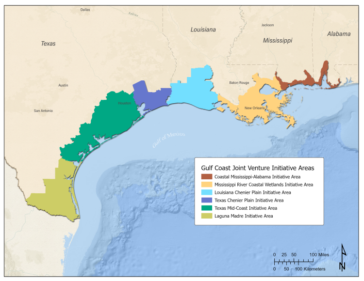
Map showing the initiative areas in the Gulf Coast Joint Venture Region.
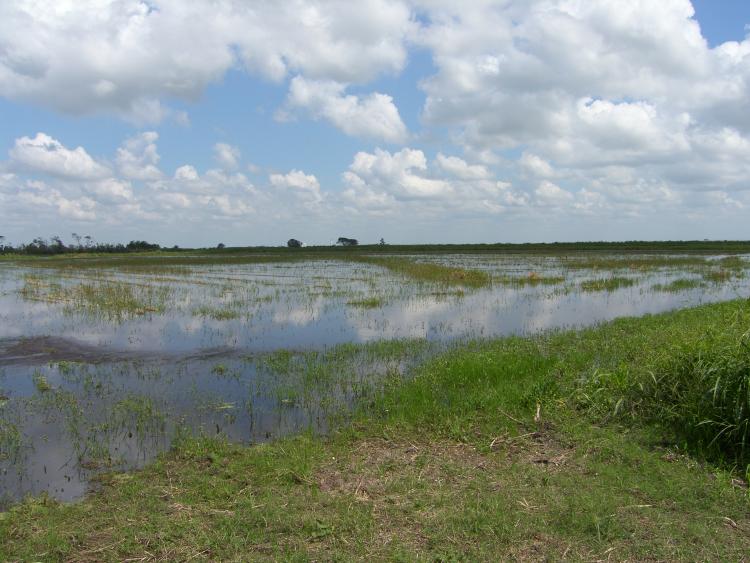
Example of flooded inland agricultural lands in the Gulf Coast Joint Venture Region. Photo credit: William Vermillion (U.S. Fish and Wildlife Service).
Disclaimer: Any use of trade, firm, or product names is for descriptive purposes only and does not imply endorsement by the U.S. Government.