
High water levels and heavy wave action have degraded shoreline, beaches, and infrastructure along the Lake Superior side of the Minnesota Point barrier island, located between the Duluth and Superior Harbor entries. The U.S. Army Corps of Engineers (USACE) has been exploring the beneficial use of dredge material for beach nourishment on the barrier island to slow the impact of erosion. The USACE has been collaborating with the U.S. Geological Survey (USGS) since 2019 to collect bathymetry and terrestrial lidar data of beach and nearshore areas before and after beach nourishment. The data are used to evaluate movement of placed material and overall changes to the barrier island and surrounding nearshore area.
The USGS collected bathymetric elevation data for shallow water less than 2 meters deep using a single-beam sonar and for depths greater than 2 meters using a multibeam echosounder. Land surface elevation of the beach was collected using a boat-mounted lidar. The USGS has released the data (available here) from these surveys in XYZ and LAS formats, and as digital elevation models referenced to the International Great Lakes Datum of 1985). The results of the study will provide the USACE with bathymetry and terrestrial lidar data that allow evaluation of 1) the changes to beach and surrounding nearshore areas following placement of dredge material and 2) the extent that dredge material is moved by waves, ice, and nearshore currents. These data will allow management to determine whether beneficial use of dredge material for beach nourishment is an effective way to reduce erosion problems throughout the Great Lakes.
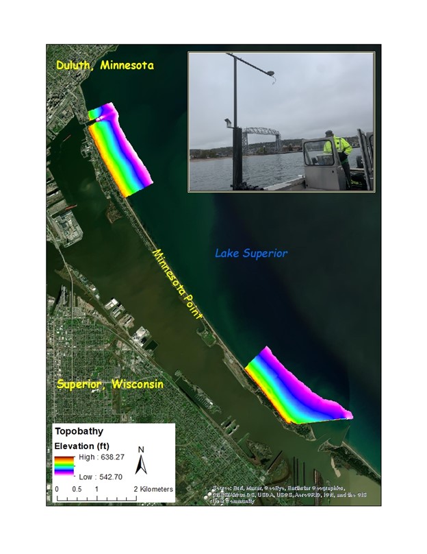
An elevation map of the beach and nearshore survey areas along the Minnesota Point barrier island of Lake Superior. Inset image shows multibeam data collection.
Disclaimer: Any use of trade, firm, or product names is for descriptive purposes only and does not imply endorsement by the U.S. Government.