
The U.S. Geological Survey (USGS) Geosciences and Environmental Change Science Center and the Earth Resources Observation and Science (EROS) Center have led the development, validation, and production of the Landsat Burned Area products. The algorithm that generates the products identifies burned areas in Landsat images, which have a spatial resolution of 30 meters and a temporal resolution of 16 days or more, depending on cloud cover. Fires are frequently unreported; consequently, existing fire databases are often incomplete and have location errors and duplicate records. The Landsat Burned Area products provide new and unique information about spatial and temporal patterns of fire occurrence that existing fire databases may lack, especially in areas where fire information can be incomplete, such as in the Great Plains and the western and southeastern United States. Scene-level products are available through the USGS EarthExplorer. Annual composites based on Collection 1 Landsat Analysis Ready Data (ARD) are available for 1984-2021, while annual products based on Collection 2 Landsat ARD data are available for 2022.
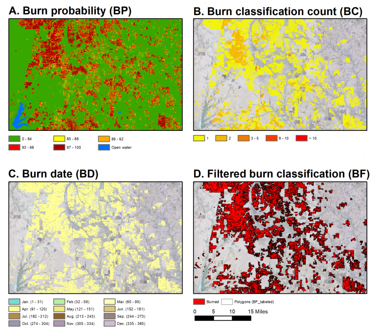
Examples of the Landsat Burned Area annual composite products.
Disclaimer: Any use of trade, firm, or product names is for descriptive purposes only and does not imply endorsement by the U.S. Government.