
A vital aspect of U.S. Fish and Wildlife Service fire management is to conduct fuels treatments that maintain habitat for wildlife, reduce the risk of large wildfires and maintain viewsheds. The Buenos Aires National Wildlife Refuge (BANWR) in southern Arizona faces several fire management challenges that make implementation of the Multi-Unit Burn Plan difficult across grasslands, mesquite savanna, and shrubland habitats. Importantly, the encroachment of woody plants (primarily mesquite) and the invasion of non-native Lehmann lovegrass and buffelgrass can substantially alter fuel load, fire hazard, and fire-line intensity. Frequent fire applied on the refuge can reduce woody plant cover but may also increase the spread of tall-statured non-native grasses, which enhance fire rates of spread and reduce travel time. Invasive non-native perennial grasses can often outcompete short-structured native grasses on suitable sites, which subsequently alters fuel-bed structure and fire return intervals. Dense and more continuous fine-fuels can recover quickly and accumulate with continued burning (more than 4 fires over a 30-yr period) when non-native grasses are present. These conditions can decrease critically endangered masked bobwhite habitat suitability and affect other BANWR listed species, while increasing fire size and intensity. Southern Arizona has also experienced enhanced aridity in the last three decades, which has altered the balance between woody plants and grasses and created additional fire risk. These changing conditions often make it difficult to broadly apply LANDFIRE spatial layers and fuel models to determine areas of high fire hazard and risk before and after fuels treatments. However, careful integration of the regional ecology with downscaled spatial and remote sensing products can improve characterization of fuels and help define how future treatments can improve habitat, minimize future fire risk, and improve viewsheds.
Together, researchers and managers from the USGS, U.S. Fish and Wildlife Service, and the Department of the Interior Office of Wildland Fire aim to 1) refine refuge-wide fuels mapping methods with ‘analysis ready’ satellite imagery and ground-based measurements that can be expanded to the greater southern border region, 2) retrospectively determine post-fire recovery periods and fuels treatment effects on fuel accretion in the context of biophysical factors, and 3) assess current and future fire behavior under plausible management scenarios with the use of updated dryland fuel models and fire behavior simulations.
https://www.doi.gov/wildlandfire/southern-border-fuels-management
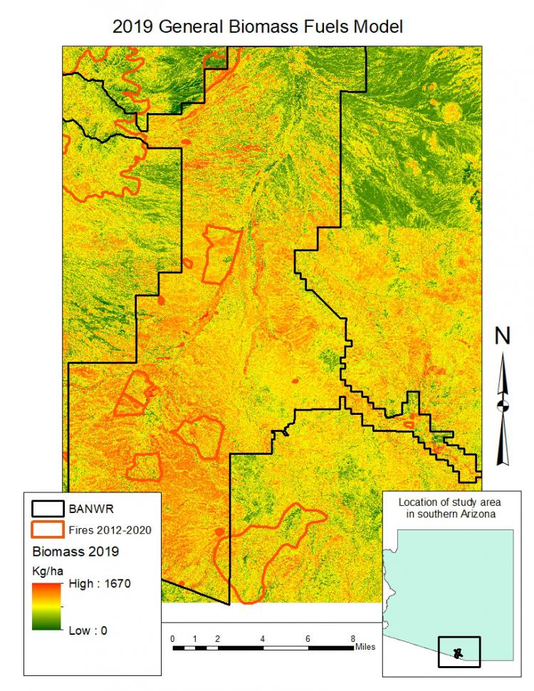
General biomass model derived from vegetation plot data and Sentinel-2A imagery collected during leaf-on and leaf-off seasons used as a basis for distinguishing fuels loads based on pre- and post-treatment effects of wildfire, fuels management (prescribed fire and physical thinning), as well as a baseline model for fire simulation models and forecasting.