U.S. Geological Survey (USGS) scientists have produced a unique set of land cover projections for the conterminous United States based on Intergovernmental Panel on Climate Change (IPCC) scenarios (http://www.esajournals.org/doi/full/10.1890/13-1245.1). Scenario-based projections of land use and land cover (LULC) change are needed to quantify the potential for biological carbon sequestration and to analyze strategies to mitigate impacts of greenhouse gas emissions.
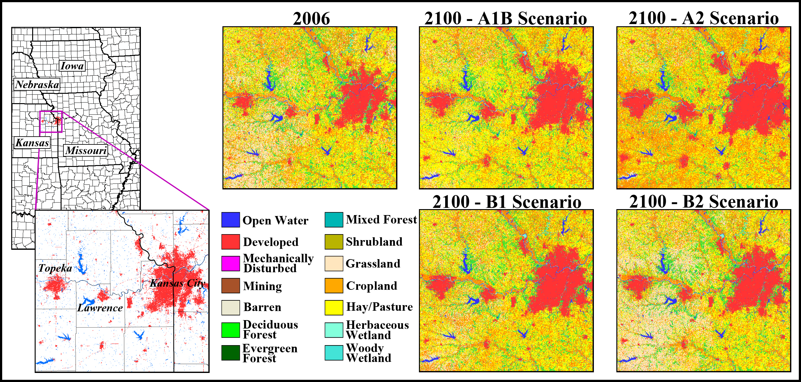
The FORE-SCE (FOREcasting SCEnarios of land use change) model was used to produce the LULC projections (http://www.tandfonline.com/doi/abs/10.1080/17474230701218202#.U8AdzPldWgY). Four scenarios were generated, each consistent with storylines from the IPCC Special Report on Emissions Scenarios (SRES) (scenarios A1B, A2, B1, and B2). Scenario storylines were quantified to regional proportions of LULC change in a workshop that relied on existing modeling frameworks, historical information on LULC change, and expert knowledge. FORE-SCE uses the quantified scenarios to produce spatially explicit, annual LULC maps for each scenario, matching the quantity of prescribed LULC change from each scenario.
FORE-SCE produced annual, 250-m resolution LULC maps for each of the four IPCC SRES scenarios from 1992 to 2100. With 17 individual LULC classes modeled, these projections are the first to provide high thematic resolution data for the conterminous United States at a relatively high spatial resolution. FORE-SCE also produces data layers on forest stand age, information that scientists can use to represent forest structure in the future. The projections have been used to generate the first, high spatial resolution analysis of future carbon sequestration and greenhouse gas emissions for the conterminous United States. The fine temporal, spatial, and thematic resolutions also make the scenario-based projections useful for analyzing the influence of projected LULC change on other ecological processes, including hydrology and water quality, biodiversity, and regional weather and climate variability.
Both the spatially explicit LULC projections and the forest stand age data layers are available through a USGS Earth Resources Observation and Science (EROS) Center land cover modeling Web site (http://landcover-modeling.cr.usgs.gov).
http://landcover-modeling.cr.usgs.gov

An example of modeled land use and land cover change from 2006 through 2100 near Kansas City, Missouri, for the four Intergovernmental Panel on Climate Change scenarios (http://www.ipcc.ch/ipccreports/sres/emission/index.php?idp=0).

