Essential climate variables (ECVs) can be used to track critical attributes of atmospheric, oceanic, and terrestrial systems over time scales appropriate for analyzing their relationships with climate change. As part of a larger Climate Data Record (CDR) and ECV Development project, scientists at the USGS Geosciences and Environmental Change Science Center in Denver, Colorado, are leading the development and validation of the Burned Area ECV algorithm. This algorithm automatically extracts burned areas from Landsat imagery with a spatial resolution of 30 m and a temporal resolution of 16 days or more, depending on cloud cover. Fires are frequently unreported; consequently, existing fire databases are often incomplete. Furthermore, these databases often have location errors, and records may be duplicated. The Burned Area ECV products will provide new and unique information about spatial and temporal patterns of fire occurrence that existing fire databases may lack, especially in areas such as the shrub and grassland ecosystems in the West, the Great Plains, and the Southeastern United States. Validation protocols are being established incorporating and adapting the Committee on Earth Observation Satellites (CEOS) Land Product Validation (LPV) Subgroup's best practice guidelines in collaboration with the European Space Agency Climate Change Initiative ECV Fire Disturbance (fire_cci) validation team.
http://remotesensing.usgs.gov/ecv/BA_overview.php

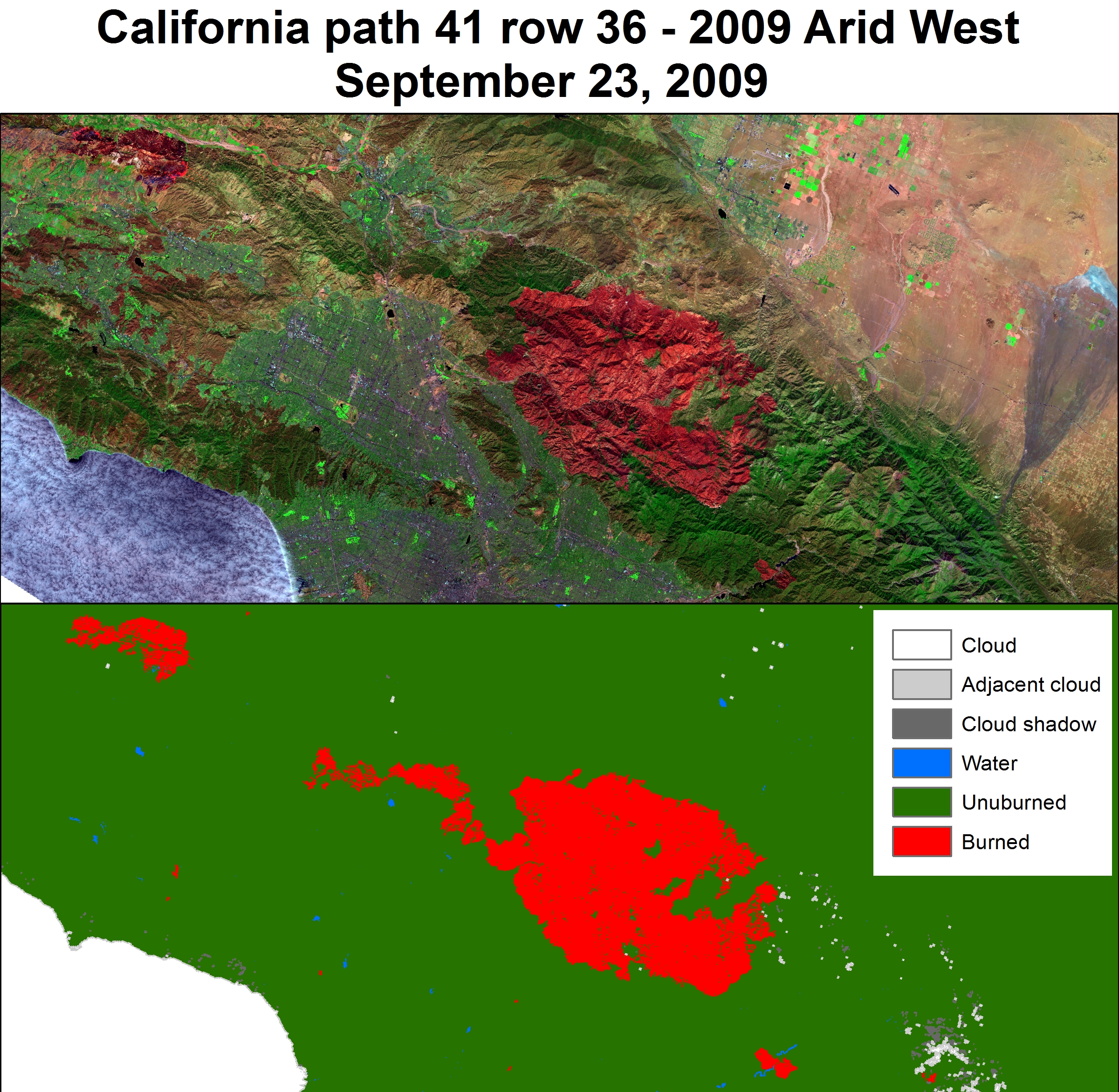
A portion of southern California northwest of the Los Angeles Basin (Landsat path 41/row 36) for September 23, 2009. The upper image is the original Landsat scene (spectral bands 7, 4, 2 displayed as red, green, blue, respectively, to highlight the burn scars). The lower image shows the Burned Area ECV classification with the bright red areas indicating a burned area and dark green indicating an area not classified as burned. The large burn scar in the center of the image is the Station Fire.

