Decades of intensive off-road vehicle use for border security, immigration, smuggling, recreation, and military training along the United States-Mexico border has prompted concerns about long-term human impacts on sensitive desert ecosystems. To help managers identify areas susceptible to soil erosion from anthropogenic activities, we developed a series of landscape-scale erosion vulnerability models based on factors from the Universal Soil Loss Equation (USLE). To better express the vulnerability of soils to human disturbances, we used remote sensing imagery and field data to refine two model factors whose categorical and spatial representations limit the application of the USLE for non-agricultural landscapes: the C-factor (vegetation cover) and the P-factor (support practice/management). A soil compaction index (P-factor) was calculated as the difference in saturated hydrologic conductivity (Ks) between disturbed and undisturbed soils, which was then applied to maps of vehicle disturbances digitized from aerial imagery. The C-factor was improved upon with Landsat TM vegetation index data, which were better correlated with estimated ground cover (r2 = 0.77) than C-factor data based on land cover maps (r2 = 0.06). The erosion potential models capture spatial patterns of both fine- and broad-scale factors contributing to natural and anthropogenic erosion and are at a scale appropriate for adaptive management and restoration of arid environments.

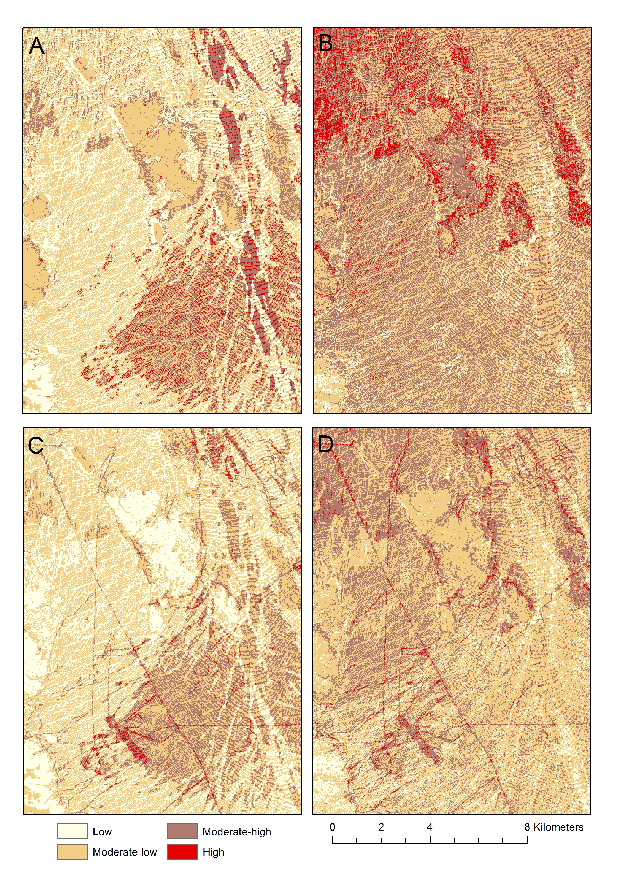
Information from satellite imagery helped to differentiate areas vulnerable to soil erosion from off-highway vehicle use. For this study we developed a “P-factor” by scaling ground measurements of soil compaction to vehicle disturbances mapped from aerial imagery. We also used NDVI to better represent the spatial complexity of vegetation cover, which helps to reduce soil erosion. This figure shows four Erosion Potential Models based on different input factors: A) land cover model with no P-factor, B) Landsat NDVI model with no P-factor, C) land cover model with P-factor, and D) Landsat NDVI model with P-factor. The models that include NDVI and P-factor data can be used by managers to better identify areas sensitive to erosion from anthropogenic land uses.

