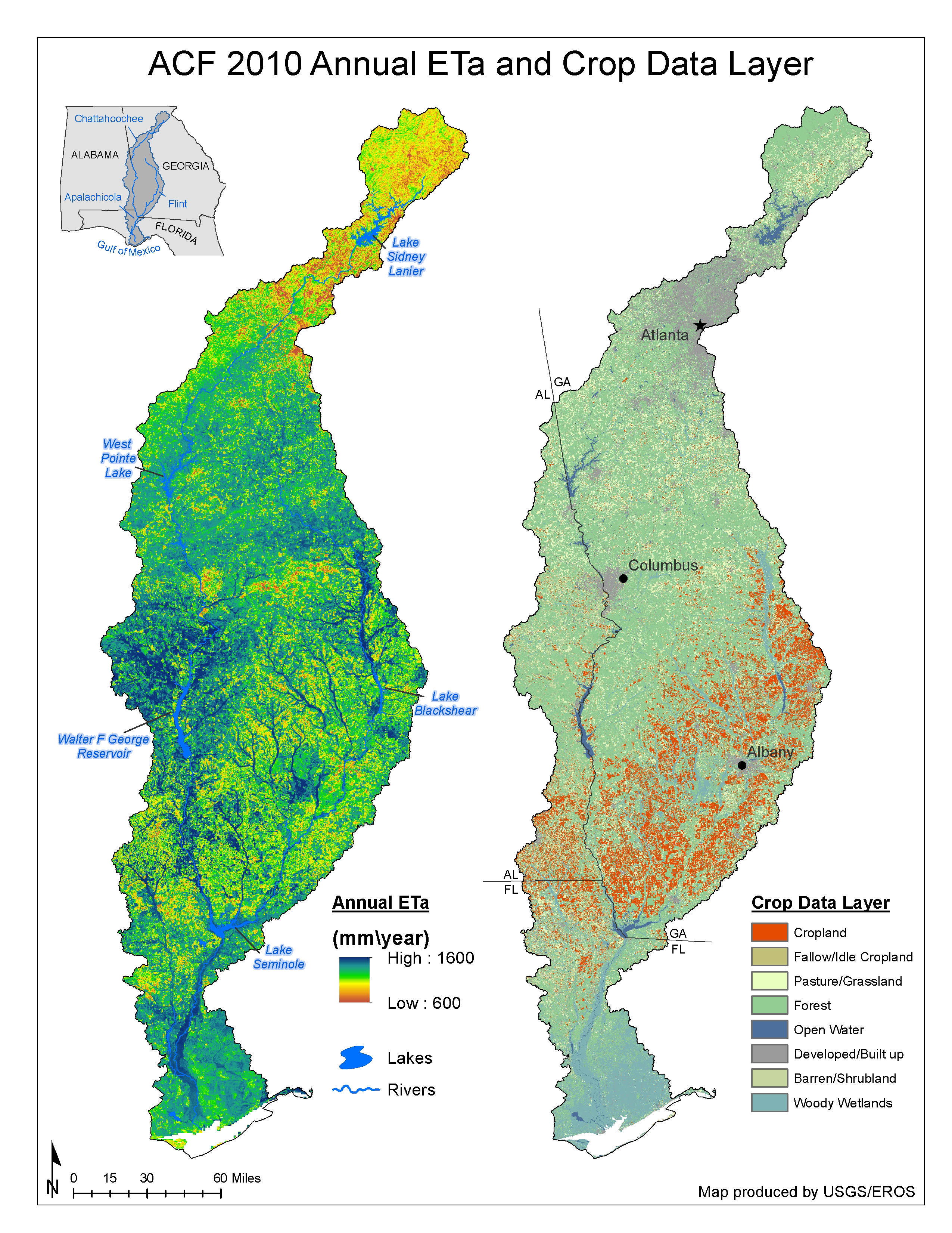
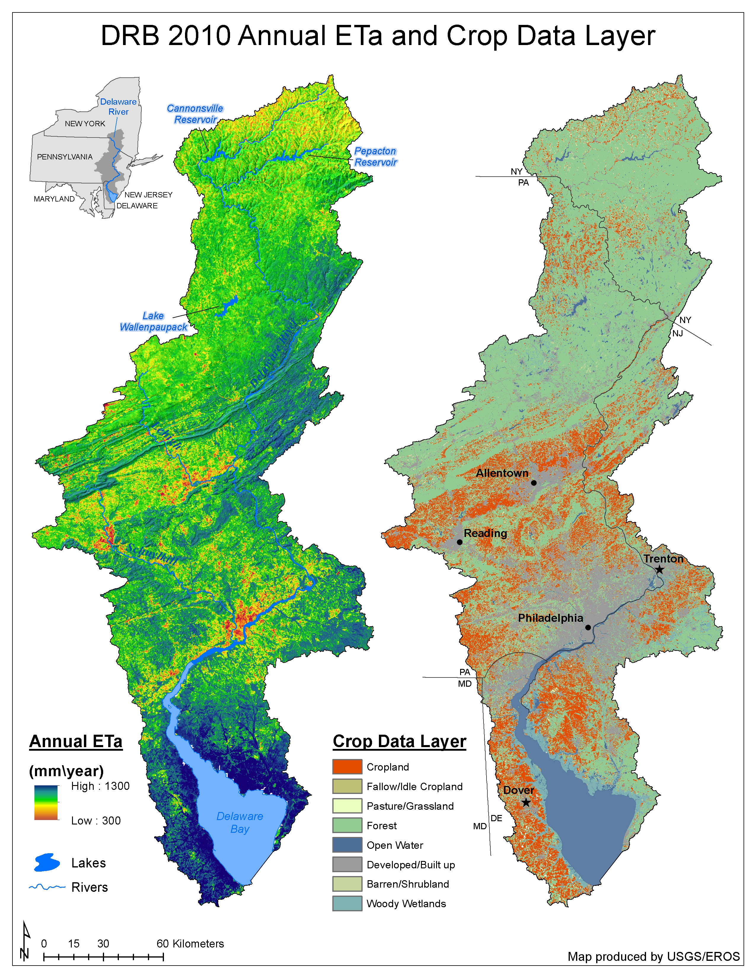
The USGS WaterSMART (Water for Sustainable Management of America’s Resources for Tomorrow) Program aims to quantify the year-to-year variability of vegetation water use (consumptive use). WaterSMART focuses on irrigated lands and seeks to make previous year consumptive use estimates available in a cost-effective and timely manner before the next irrigation season starts. USGS scientists improve upon existing hydrologic models to estimate and validate evapotranspiration (ET) from irrigated lands and the general landscape using a combination of satellite data and weather datasets. In the current effort, the first ever basinwide ET estimate was produced for the Apalachicola-Chattahoochee-Flint (ACF) and Delaware River Basins (at a spatial resolution of 100 m corresponding to Landsat’s thermal band) using the Operational Simplified Surface Energy Balance (SSEBop) approach.
For the first time ever, seamless monthly and annual ET maps for 2010 were produced for the ACF and Delaware Basins. These products clearly show the spatial distribution of ET in the basins and magnitude differences associated with different land cover types. The ability to estimate seamless ET at the Landsat scale will enable the creation of basinwide consistent ET estimates for hydrological applications that are relevant for local decision making in water resources planning and management. This project demonstrates the potential to create a nationwide ET map at the Landsat scale using the Landsat 8 data stream.
USGS will continue to evaluate and apply Landsat-based ET for consumptive use change detection, trend analysis, and groundwater recharge/withdrawal studies.

Annual evapotranspiration map and a crop data layer for 2010 in the Apalachicola-Chattahoochee-Flint River Basin.

Annual evapotranspiration map and a crop data layer for 2010 in the Delaware River Basin.

