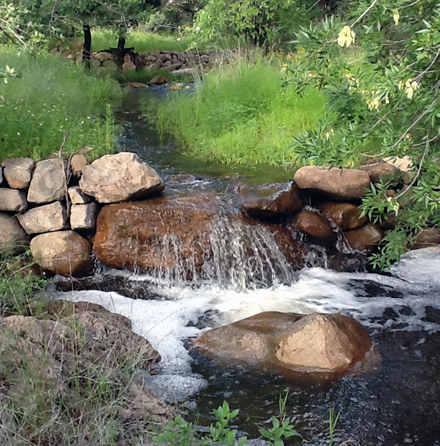
People living in arid environments seek adaptation practices in order to sustain development and agriculture in changing climates. An effort to install water harvesting devices in local riparian zones of the U.S.-Mexico border has recently been revived in both private and public lands in this region using different kinds of rock detention structures. The USGS is investigating the impacts of different water harvesting devices using hydrologic models and coupling geospatial and remotely sensed data to identify sites for future installation. A temporal suite of Landsat Thematic Mapper imagery and derived Normalized Difference Vegetation Index (NDVI) values are being used to monitor changes in vegetation greenness. Watershed models, including the Soil and Water Assessment Tool (SWAT) and the Kinematic Runoff and Erosion Model (KINEROS2) are being used with terrestrial lidar (T-lidar) datasets to monitor changes in surface flow, infiltration, and sediment build-up at new check dams and detention features. T-lidar data are also being used to examine changes in vegetation structure and channel dimensions. Hydrographs are developed using a modified Continuous Slope Area method to be input to calibrate watershed models for long-term predictions. Results are currently being published in peer-reviewed journals and suggest that rock detention features are able to maintain water supplies during drought conditions to both re-establish and support perennial availability and associated riparian vegetation at and below restoration sites.
http://geography.wr.usgs.gov/science/aridlands/index.html

In-channel rock detention structures in the Chiricahua Mountains, southeastern Arizona.

