Our objective was to extend existing land use/land cover (LULC) change records for the Central California Valley ecoregion through 2010, comparing current land change dynamics to previously historical LULC change efforts. By dating historical LULC records via manual interpretation of Landsat imagery, we increased the temporal record of LULC change monitoring to 37 years (1973–2010). Results include six new annual LULC classification dates (2005, 2006, 2007, 2008, 2009, and 2010), two new multi-year intervals (2000–2005, 2005–2010), and documentation of the implications of varying temporal analyses in determining driving forces of LULC changes, while also discussing the benefits and drawbacks of using annual versus interval-based estimates of land change. Further, analyses summarize LULC change in the Central California Valley since 2000. From 2005 to 2010, agriculture in the region fluctuated along with regulatory-driven changes in water allocation as well as persistent drought conditions. Grasslands and shrublands declined, while developed lands increased in former agricultural and grassland/shrublands. Development rates stagnated in 2007, coinciding with the onset of the foreclosure crisis in California and the global economic downturn.

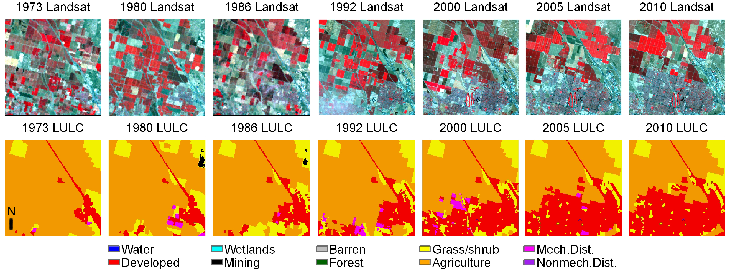
An example of seven dates of Landsat imagery and corresponding LULC data for a sample block located on the edge of Bakersfield, California. LULC maps not shown include 2006, 2007, 2008, and 2009.

