For the project on the background water quality and geochemistry of three watersheds in the Duluth Complex, the USGS is using the 1-m resolution hillshade lidar derivative products from Lake and St. Louis Counties in Minnesota as the base digital elevation model. Over this base, we drape the semi-transparent digital geology, both bedrock and Quaternary layers, to visualize the distribution of the various units. In many places with thin glacial cover, we can recognize possible bedrock sample sites. In places with thicker glacial cover, the landscape texture is a guide to the sediment type and setting. The soil sample location sites will be determined using the digital geology over lidar. Geochemical data from multiple sources can be better understood using the lidar data; for example, locations of water samples collected from seeps plot consistently along certain recognizable slopes. Using lidar in conjunction with other spatial and point data has greatly improved our understanding of the landscape controls for water quality and geochemistry for this project.
http://mn.water.usgs.gov/about/newsletter/2013_2014_Winter/

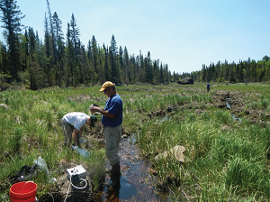
Robert Seal, Nadine Piatek, and Russell Buesing collect water-quality samples and measure stream discharge at sites on Keeley Creek, Minnesota. Water-quality sampling is being done in cooperation with the USFS.

