The USGS Northern Prairie Wildlife Research Center in cooperation with the USACE is investigating least tern and piping plover habitats in terms of the dynamics of land cover and emergent sandbars on the Garrison, Fort Randall, Lewis and Clark Lake, and Gavins Point segments of the Missouri River. Remotely sensed, submeter resolution images from WorldView-2 and GeoEye, and 6-m resolution RapidEye images, are acquired multiple times each year. Land cover and emergent sandbars are mapped using a prototype knowledge- and object-based image analysis model developed for the Missouri River. Investigations include the dynamics of plant succession on sandbars, fluvial erosion of sandbars, sandbar area variability related to discharge, and spatial and temporal distribution of sandbars. Information about habitat dynamics is used in an adaptive management program and investigations of least tern and piping plover population dynamics.
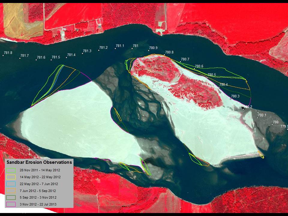
Erosion and plant succession of sandbars on the Gavins Point and the Garrison segments of the Missouri River following the 2011 flood were recently quantified from analysis of 2012 and 2013 GeoEye, WorldView-2, and RapidEye imagery. Analysis revealed the Gavins Point and Garrison segments of the Missouri River lost 695 and 876 hectares (ha), respectively, of emergent and floodplain sandbars (sandbars attached to river banks at the time of imaging) to erosion and plant succession (1 ha is equal to 10,000 m2). Erosion of sandbars was greater on Gavins Point, 344 ha, than on Garrison, 131 ha. Erosion of emergent and floodplain sandbars was similar on Gavins Point, but erosion of emergent sandbars was greater than erosion of floodplain sandbars on Garrison. Plant succession on sandbars was less on Gavins Point, 351 ha, than on Garrison, 745 ha. Plant succession on floodplain sandbars was greater than plant succession on emergent sandbars on both river segments.

Observations of erosion following the 2011 flood for sandbars on the Gavins Point segment of the Missouri River mile 781 overlaid on a pan-sharpened, color infrared WorldView-2 image from July 22, 2013.

