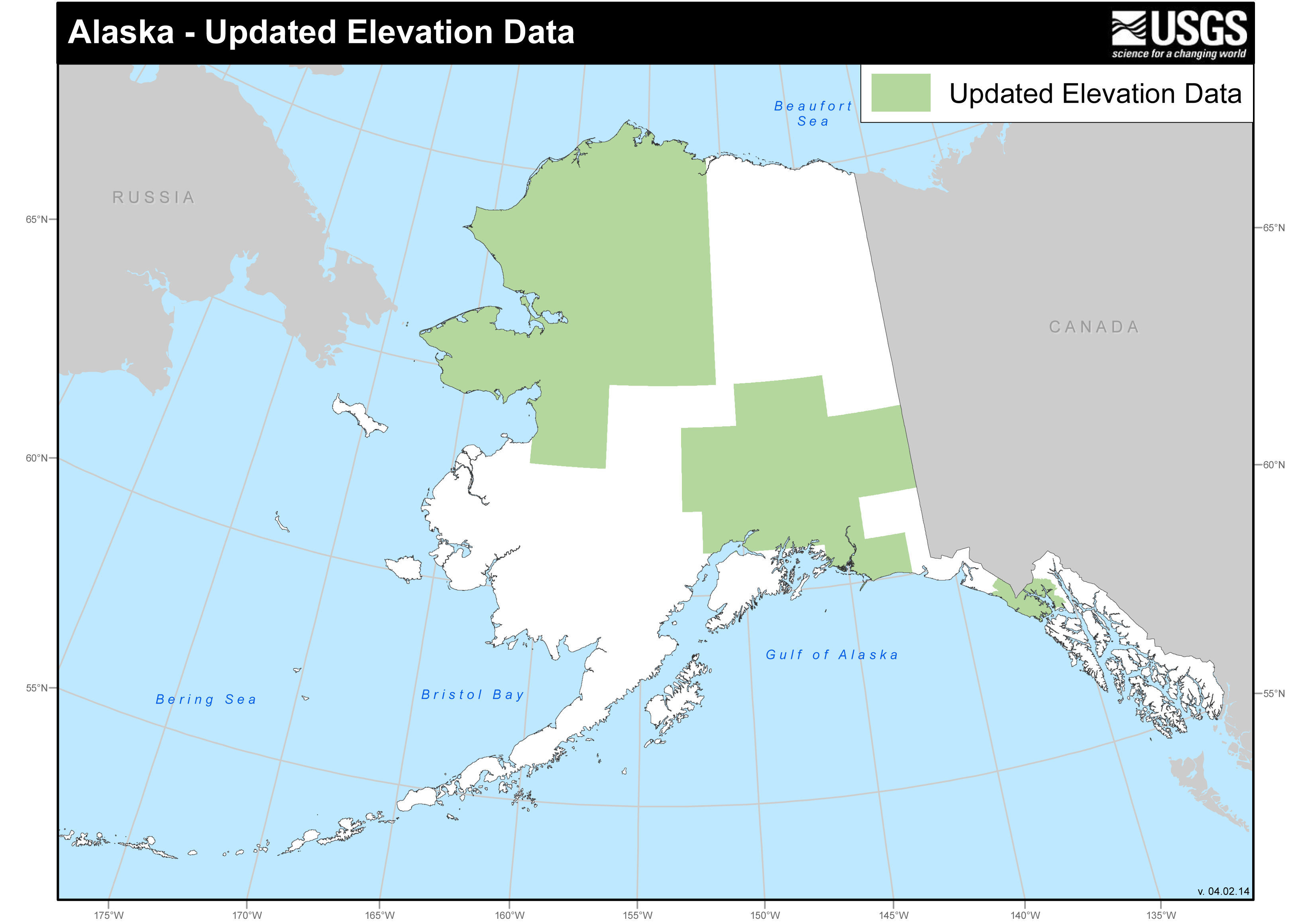
USGS has collaborated with other Federal agencies and the State of Alaska to acquire Interferometric Synthetic Aperture Radar (IFSAR) data over large areas of Alaska. Data from over 43% of the State have been collected to date, and plans have been established to pursue statewide IFSAR completion over the next several years. Many organizations are beginning to use the data deliverables, which include a digital surface model, a digital terrain model, and an orthorectified radar image. The data are used by the USGS for mineral assessments and by the U.S. Fish and Wildlife Service (USFWS) to delineate wetlands. Furthermore, several ice and glacier studies are underway, taking advantage of the ice-penetrating capabilities of a specific IFSAR sensor. The data are used to support image registration and image sharpening, and to improve surface-water depiction in the National Hydrography Dataset (http://nhd.usgs.gov/).
http://nationalmap.gov/alaska/

Updated elevation data for Alaska.

