Storm-surge flooding and marsh dieback resulting from Hurricanes Gustav and Ike were mapped throughout coastal Louisiana by fusing radar and optical satellite image data. Subcanopy surge flooding was mapped with synthetic aperture radar (SAR) data obtained from C-band advanced SAR (ASAR) aboard the European Space Agency’s Environmental Satellite and phased array type L-band SAR (PALSAR) aboard Japan’s ALOS. Marsh dieback was mapped with optical data obtained from Landsat’s TM sensor. An overlay of the surge flooding and dieback extents proved the direct causal relationship between marsh dieback exposure to the elevated salinity surge waters. Extended analyses of the optical data determined the severity of marsh damage exhibited by the dieback (or marsh browning) varied by species and estimated the duration of exposure to the elevated salinity waters. These results provide the first direct mapping of a spatially extensive marsh dieback event, its cause, and severity.
http://jcronline.org/doi/pdf/10.2112/JCOASTRES-D-11-00052.1

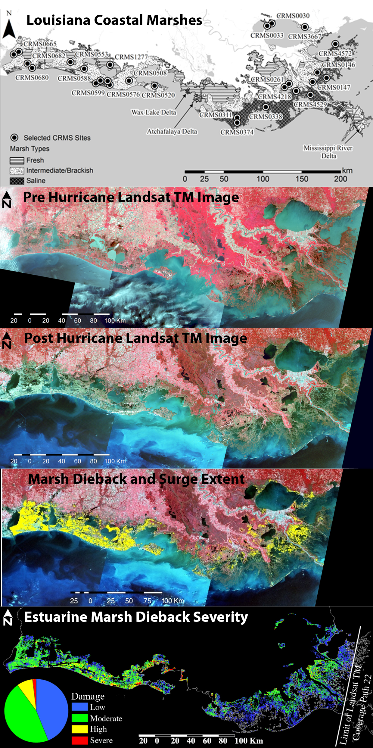
From the top to the bottom. (1) The Louisiana coastal marshes and locations of the hydrology stations used to validate Hurricanes Gustav (1 September 2008) and Ike (13 September 2008) and Ike SAR-based surge flood mapping. (2) The pre-hurricane TM image composite depicting green vegetation in red tones and the water in blue tones. (3) The post-hurricane TM image composite clearly revealing the dramatic sudden dieback of the coastal marsh as a tonal change from red to grey. (4) The high correspondence of the SAR-based surge extent (yellow) and the marsh dieback demonstrating the direct causal link of elevated salinity surge and marsh dieback. (5) The marsh damage caused by Hurricanes Gustav and Ike surge flooding. The variability is predominantly associated with changes in marsh type and exposure to the surge.

