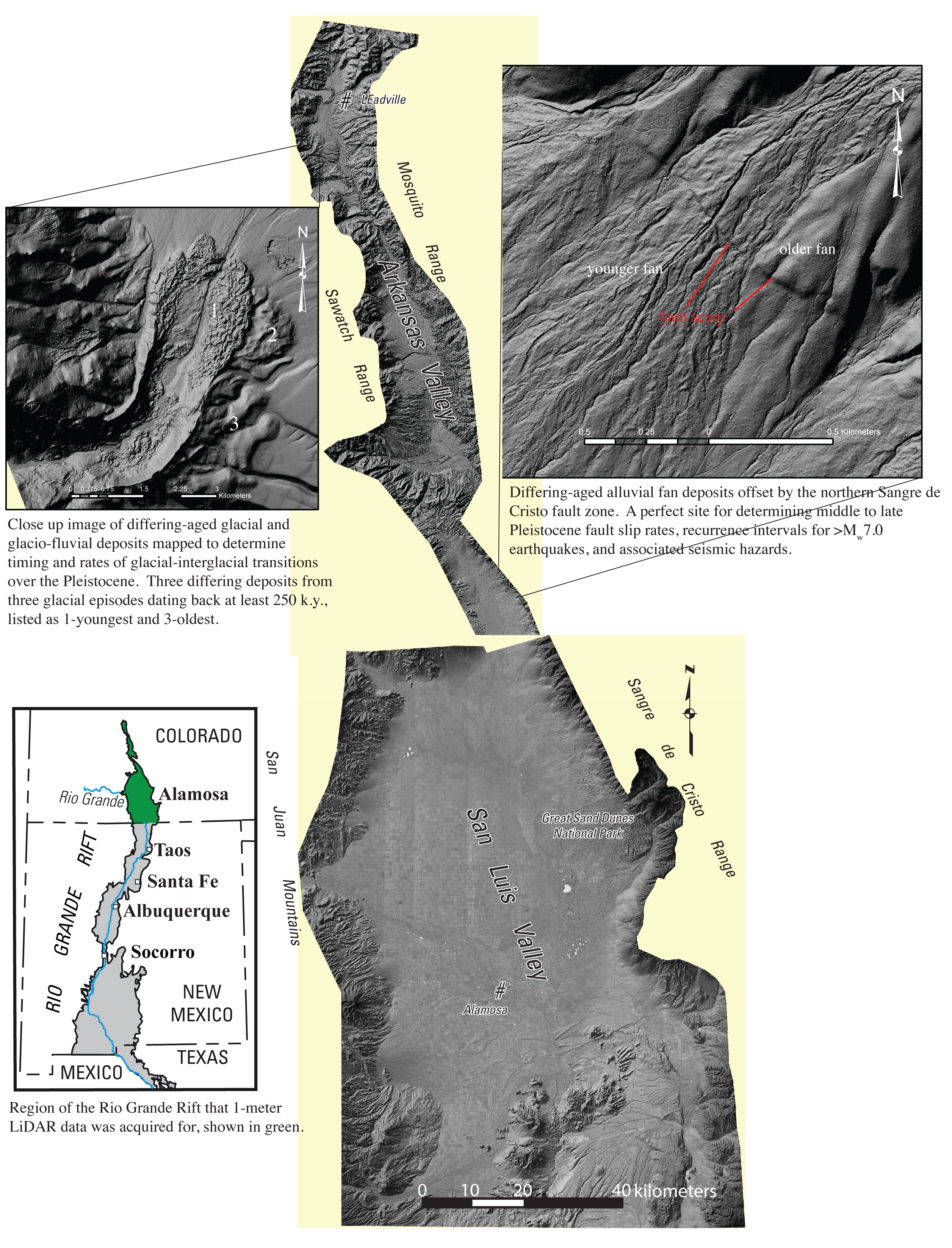
This project investigates the geologic framework of basins and adjoining mountain flanks along the Rio Grande Rift in different areas of the Southwestern U.S. to provide information on critical groundwater aquifers, hazards (seismic, subsidence, landslide), climate change rates, and resources (minerals, energy). We are using lidar, aeromagnetic and gravity data, and Landsat imagery to identify and map bedrock and surficial features and landforms to address these issues.
Mapping is integrated with studies of stratigraphy, biostratigraphy, magnetostratigraphy, and hydrogeologic characteristics of basin-fill sequences, and structural geology with emphasis on major faults and their effects on groundwater and seismic hazards. Geophysical mapping uses high-resolution aeromagnetic, gravity, and electromagnetic surveys to understand faulting and basin geometry. By exploring relations among rift tectonics, late Cenozoic climate, rift-basin sedimentation, bimodal volcanism, and landscape evolution, the project will be able to forecast subsurface hydrogeologic, seismic, and climate change characteristics in areas where information is sparse. High-resolution (1-m) lidar data are critical to identify surficial features related to the tectonic and geomorphic evolution of the region to be compared with geophysical analyses of subsurface data. These lidar and geophysical datasets assist in the accurate identification of rift and pre-rift involved structures.

Current footprint of lidar data presently acquired within the study region. This footprint is approximately one-fifth of the entire study region.

